

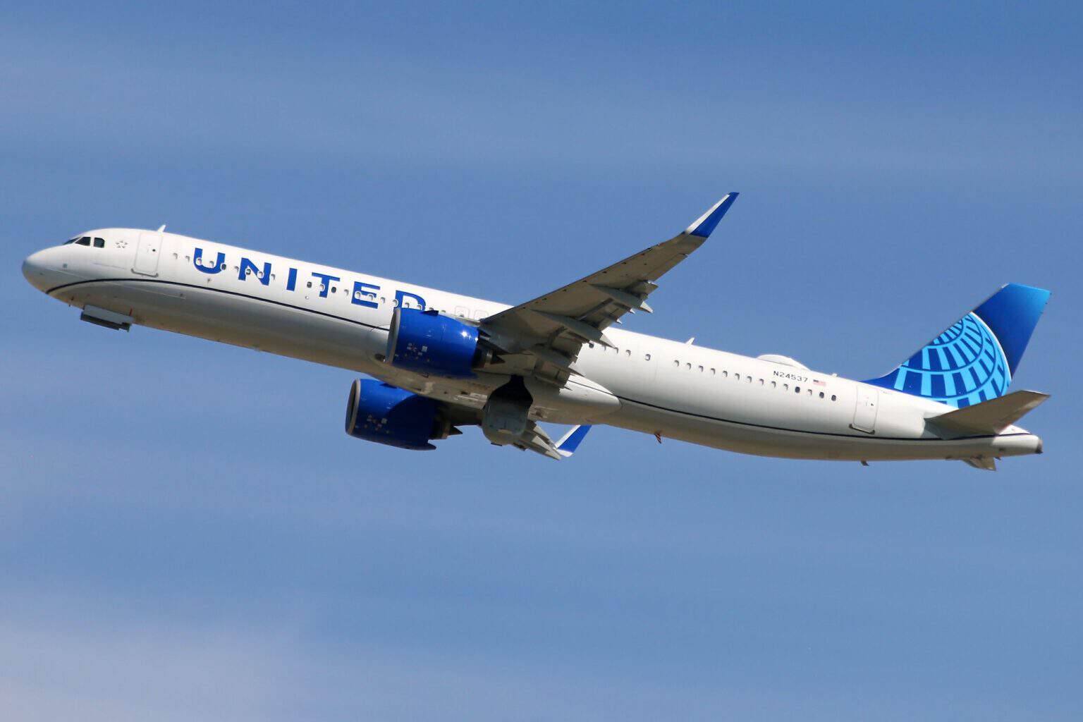
United Airlines flights UA1962 and UA1866 both reported GPS jamming near Los Angeles in the early hours of Friday, September 25, 2026. UA1962 was climbing out of LAX for Chicago, and UA1866 was cruising at 35,000 feet on its way from San Francisco to Dallas/Fort Worth.
Both jets continued to their destinations. The reports came inside a nightly window the FAA had published for GPS interference testing centered on China Lake, California, although no official source has linked the two.
What the two crews reported
According to AIRLIVE, the UA1962 crew told air traffic control at 07:36 UTC (12:36 a.m. Pacific) that jamming had compromised the aircraft’s satellite navigation shortly into the climb. The aircraft was an Airbus A321neo, registration N24542.
At 08:15 UTC (1:15 a.m. Pacific), the UA1866 crew reported similar interference at 35,000 feet near Los Angeles, the same report says.
FlightAware data shows UA1962 left LAX at 12:17 a.m. Pacific and reached O’Hare at 5:50 a.m. Central. UA1866, an Airbus A320, left SFO at 12:38 a.m. Pacific and landed at DFW at 5:50 a.m. Central.
AIRLIVE also named Alaska Airlines AS222, a Boeing 737 MAX 9 flying San Diego to Kona, as affected in an offshore sector off the coast of Los Angeles. That flight departs around midday Pacific, well outside the overnight test window, and the report does not say when its encounter happened.
The test the FAA had announced
An FAA flight advisory, CHLKCA GPS 26-07, scheduled GPS interference testing centered on China Lake every night from September 20 to 25. Each window ran from 06:01 to 13:00 UTC, which is 11:01 p.m. to 6:00 a.m. Pacific, and both United reports fall inside it.
The advisory warns that GPS, including the WAAS and GBAS augmentation systems and ADS-B, may not be available inside a zone that grows with altitude. It reaches 201 nautical miles from the center at 10,000 feet and 346 nautical miles at 40,000 feet and above.
China Lake is a Navy weapons test range north-northeast of Los Angeles, and its advisory’s center point sits about 114 nautical miles from LAX, by AeroCorner’s calculation. A separate FAA advisory for the Point Mugu Sea Range covered daytime hours only, ending on September 24.
The FAA says the US government “regularly conducts GPS tests, training activities, and exercises that interfere with GPS signals,” and that these events are scheduled and posted through NOTAMs and FAA public notices. AeroCorner found no FAA or United statement on either flight at the time of writing.
Why the jets kept flying, and who carries the risk
An airliner does not navigate on GPS alone. It blends inertial reference and ground radio beacons with the satellite signal, as our guide to the four layers of airline navigation explains, so losing GPS at cruise is a workload problem rather than an emergency.
The advisory itself asks pilots to report any anomalies they see. Reports like these give the FAA a record of where the interference was actually felt, not just where the test plan drew its circle.
The advisory names ADS-B because it broadcasts a position taken from satellite navigation, so the position data controllers and flight trackers receive can degrade with GPS. In the New Mexico case below, the NTSB’s timeline shows ADS-B updates slowing from every 2 to 3 seconds to about once a minute during the jamming, and recovering when it paused.
The risk is higher in small aircraft that lean on a single GPS navigator. In May, a King Air air ambulance crashed in New Mexico during a published military GPS jamming exercise.
The NTSB’s preliminary report says three other aircraft reported losing GPS to the controller that night. That investigation has not yet reached a probable cause.
Sources and references used for research and fact-checking.
Get the Newsletter
The latest aviation news and stories sent to your inbox.
About the Author
Tim is the owner and lead editor of AeroCorner since 2019, overseeing aviation content covering aircraft, airlines, airports, and the broader aviation industry. Through years of researching, writing, editing, and publishing aviation-focused content, he has developed extensive practical knowledge of commercial aviation and air travel. Based in Asia and a frequent traveler himself, Tim also brings firsthand passenger experience to AeroCorner’s coverage. Outside of publishing, he has also explored aviation firsthand through hands-on flight training in New Zealand.