With GPS in your car, you can simply type in where you want to go, and the GPS will calculate the estimated time of arrival and the quickest route. Have you ever wonder how an airplanes can do the same? Yes, the GPS technology was utilized on airplanes before cars. But you can easily see how it works in cars more so than planes.
How do airplanes know where to go?
In the car, GPS has a road map of streets and highways. The GPS uses signals to determine traffic flow, speed and distance to destination. The driver can follow those coordinates to their destination.
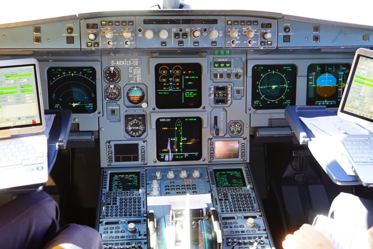
In airplanes, there are road maps of airways. The airplane GPS uses signals to analyze the wind and weather and the distance to destination. The information is inputted into the Black Box, which contains reference system data and radio navigation signals to guide the plane to the desired destination utilizing airways.
History of Flight Navigation
In the first years of piloting, pilots navigated by visual landmarks or by astronomical navigation. Mail carriers in early 1900 navigated using bonfires. The bonfires, pilotage, dead reckoning, VOR and GPS are ways in which pilot navigated throughout the years.
Pilotage
Pilotage is a technique that uses fixed points as a reference or guide. The technique is one of the first navigating technique taught to pilots. The technique included identifying landmarks that include rivers, cities, mountains, towers and lakes and compare them to printed charts.
At night, the pilots can use highways, airports and city lights to navigate. Pilotage is a simple technique to navigate. But it is not an efficient navigating technique. Pilotage is limited by weather condition when aircraft is on the ground, and the pilot vision is limited.
Dead Reckoning
Dead reckoning is a process to determine the distance between checkpoints and the aircraft location by calculating time and distance base on a specific speed. A more efficient way to determine your position and maintain a scheduled route is by using pilotage and dead reckoning together.
Non-Direction Beacon (NBD)
Non-Directional Beacon is ground-based low-frequency radio beacon transmitter. It is used as an instrumental approach for offshore platforms and airports. The Non-Direction Beacon signal is omnidirectional, and it is received by Automatic Directional Finder (ADF), which is a standard instrument on aircraft.
The ADF deciphers the signal and tells the pilot the location of the beacons and his or her location relative to the beacons. The NBD frequency is entered into the ADF instrument, which gives the pilot directions toward the station. The signal transmits 24/7 uninterrupted.
VHF Omnidirectional Range (VOR)
VOR is a short-range navigation system used by aircraft. VOR enables aircraft to determine its location or position and allows the aircraft to stay on the current course of the signals being transmitted by fixed radio beacons on the ground.
The VOR system consists of a VOR station, an instrument that displays and interprets data and an aircraft antenna. The pilot can view the aircraft position relative to the beacons from the ground station.
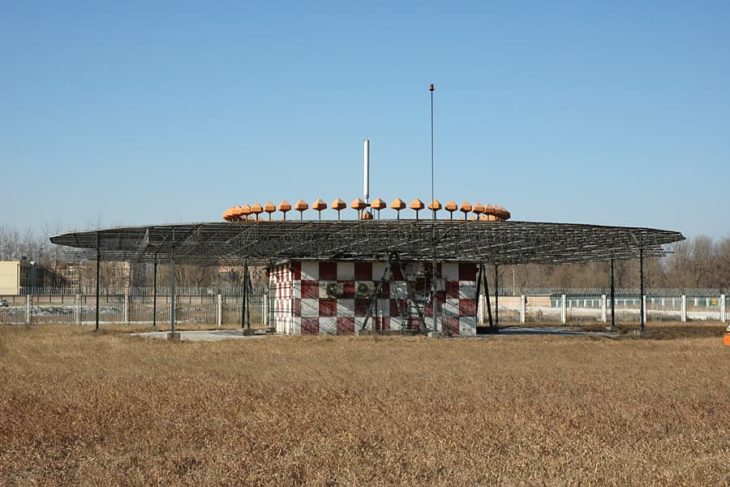
There are two signals emitted from the VOR station. One signal is a rotating signal, and the other signal emits simultaneously omnidirectional which means all directions.
The signals are measured, and the phases difference determine radial or line position from the VOR station. The positioning are between 0-360 degrees. The positions are at 180 degrees South, 90 degrees is East, 270 degrees West, 360 degrees is North.
With the positioning and the measuring equipment, the precise position can be determined to a certain VOR ground station. The United States has approximately 1,000 VOR stations Nationwide. The VOR stations are used mostly in connection with certain routes and airways in the sky.
Global Position System (GPS)
GPS is more accurate than other forms of navigation systems, and it is trusted the most. Flying with GPS is more efficient, and it can save money and time.
GPS is a global satellite navigation system created by the Department of Defense in 1973. The Global Position System can provide time information and geolocation to the GPS receivers worldwide.
A user is not needed to transmit data to the navigation system. GPS operates independently of the internet or telephonic receptions, although the use of these receptions can enhance the GPS usefulness.
GPS is based on data acquired from satellites which are transmitted to the station on the ground to the aircraft GPS receiver. The direction, speed and distance are inputted into Flight Management System (FMS) (Black Box).
Road Maps of the sky
Airways are paths that keep traffic in the air separated and organized.
Enroute charts provide an outline of the airways of the sky. Like the maps for cars, the enroute charts provide a road map of the sky for aircraft, and it shows how the airways are connected.
The way it works is a dispatcher analyze the winds and weather between two destinations. The airway system can determine the most economical route.
Flight Management System (FMS) or The Black Box
Once the route is determined, the information is fed into the Flight Management System (FMS). The Black Box is said to be the brain of the aircraft’s navigation.
The Flight management systems use several of the below signal and sensors to help the aircraft maintain its position and to guide the aircraft to its destination. Below are the signals that included in the FMS.
Global Positioning System (GPS)
Inertial Reference Systems (IRS) is a device that utilizes motion sensors, rotation sensor and a computer to calculate velocity, position and the orientation of objects in motion without external references.
Radio Aids
Navigation signals, GPS data and inertial reference system are fed in the FMS system to ensure accuracy. The FMS also contain navigation aids, airways needed for the routes and a huge database of airports. Once the route is determined, the route is sent electronically to the Air Route Traffic Center.
The Air Route Traffic Center analyzes the proposed route and determines if the current air traffic can accommodate the route. The local Air Traffic Controller will tell the pilot during pre-flight take-off if the route is clear. If so the pilot can proceed.
Sources and references used for research and fact-checking.
About the Author
Articles credited to the AeroCorner Editorial Team are created or maintained by multiple aviation contributors working under a shared editorial framework. Content is researched using authoritative aviation sources and reviewed to ensure clarity, technical accuracy, and consistency across AeroCorner.