

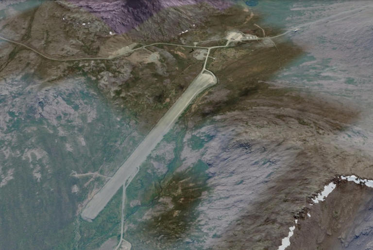
The National Transportation Safety Board released its preliminary report on September 16, 2026, into the August 20 crash of a Cessna 441 Conquest at a remote Alaska radar site that killed all eight people on board. The report, numbered WPR26FA309, does not state a cause.
What it sets out is a sequence: an approach flown twice, a failed attempt to divert, and an aircraft that crossed the missed approach point roughly 320 feet below the published minimum descent altitude, then kept descending. AeroCorner covered the crash itself in August, when little beyond the fatality count was public.
What the NTSB says happened
The airplane, registered N128EZ, was operating as a Part 135 on-demand air taxi flight from Ted Stevens Anchorage International Airport to Cape Newenham LRRS Airport. It departed at 09:11 local time.
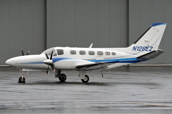
The weather collapsed underneath the flight. When it left Anchorage, Cape Newenham was reporting 10 statute miles of visibility and an 800-foot ceiling. Ninety minutes later the automated station on the field was down to a quarter of a mile in fog, overcast at 300 feet.
The crew held, flew one approach during a brief improvement, went around, tried to divert, then came back and flew the same approach again into a quarter-mile reading. No further radio calls were received from them.
09:11
Departure from Anchorage. Cape Newenham is reporting 10 statute miles visibility and an 800-foot ceiling.
10:43
Holding. The crew enters a hold at the initial approach fix. The field is now reporting quarter-mile visibility, patchy fog and overcast at 300 feet.
11:02
First approach. Cleared for the RNAV Runway 15 approach as the field briefly reports three miles in mist.
11:14
Missed approach. The crew goes around, reports visual conditions and cancels IFR. They tell a ground technician they will try Platinum Airport, 23 miles north.
11:24
They come back. Unable to raise Platinum on the radio, the crew requests a clearance for a second approach at Cape Newenham.
11:43:18
Past the missed approach point. ADS-B data shows the airplane crossing the point at about 1,000 feet, then descending to about 600 feet. Contact is lost 33 seconds later.
The two numbers that sit next to each other
The report reviews the RNAV (GPS) Runway 15 approach plate, dated July 9, 2026. The lateral navigation minimum descent altitude is 1,320 feet, and it requires three miles of visibility.
Preliminary ADS-B data in the same report shows the airplane crossing the missed approach point at 11:43:18 at about 1,000 feet, then continuing past it down to about 600 feet before contact was lost 33 seconds later.
The NTSB does not connect those figures. It prints them a page apart and leaves them there, which is what a preliminary report is for.
This is preliminary
The NTSB states no cause, no probable cause and no findings at this stage. The ADS-B track is described as preliminary data, the wreckage was still pending recovery when the report was written, and a final report normally follows a year or more later. Nothing here is a conclusion about what the crew did or why.
Why a minimum descent altitude is the number that matters
On a non-precision approach like this one, there is no glideslope guiding the aircraft down. The pilots fly a lateral track, step down to a fixed floor, the minimum descent altitude, and hold it.
That floor is not advisory. It is the altitude below which obstacle clearance is no longer guaranteed, and it can only be left when the runway environment is in sight. Here is how instrument flight rules work more broadly.
Cape Newenham makes that floor unusually unforgiving. The approach plate carries two cautions, which the NTSB quotes: the runway sits on the slope of a 2,306-foot mountain, with high terrain on both sides and at the south end, and a “successful go-around improbable if initiated past the MAP.”
That second caution is rare language on a US approach plate. It says the escape route stops existing at a specific point on the chart.
What the people on the ground saw
Two technicians at the radar facility gave statements. One had driven the runway at about 09:00 to check it for damage and wildlife, found nothing, then could not complete his usual second inspection before the arrival because of fog.
The other worked from a weather building 0.3 miles west of the approach end, relaying the automated readings by radio and augmenting them with charts of landmarks at known distances.
During the first approach, he told investigators, a reference point 1 and 7/8 miles out was already lost in fog. By the second, none of the reference points were visible and he could no longer see the runway.
He heard normal engine sounds, then the engines “throttle up,” then a “backfire,” then nothing. The wreckage was found in rising terrain about half a mile west of the approach end, the first impact point at roughly 610 feet of elevation.
The wider Alaska picture
This was the deadlier of two fatal Alaska crashes inside a week in August, a stretch that stretched NTSB investigators thin. The state’s accident rate has run well above the national figure for years, and weather-driven approaches into short strips with no tower are a large part of why.
The FAA, Textron Aviation, Honeywell Aerospace, the US Air Force, NATCA and the operator are all participating in the investigation. The wreckage was still awaiting recovery when the report was published.
Sources and references used for research and fact-checking.
Get the Newsletter
The latest aviation news and stories sent to your inbox.
About the Author
Tim is the owner and lead editor of AeroCorner since 2019, overseeing aviation content covering aircraft, airlines, airports, and the broader aviation industry. Through years of researching, writing, editing, and publishing aviation-focused content, he has developed extensive practical knowledge of commercial aviation and air travel. Based in Asia and a frequent traveler himself, Tim also brings firsthand passenger experience to AeroCorner’s coverage. Outside of publishing, he has also explored aviation firsthand through hands-on flight training in New Zealand.