

Table of Contents
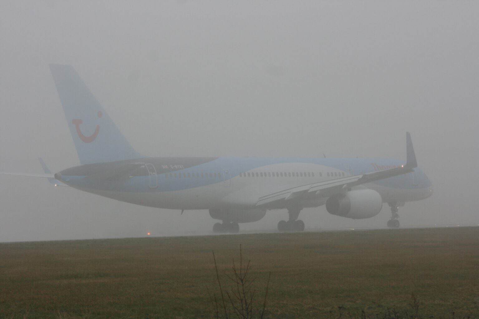
Fog and mist are the same thing: tiny water droplets hanging in the air at ground level. The official dividing line is how far you can see. In a US weather report, visibility under 5/8 mile (1 km) is fog, and anything from 5/8 mile out to 7 miles (11 km) is mist.
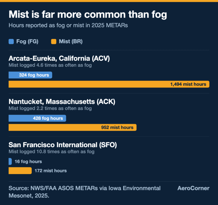
Mist is also far more common. At three coastal US airports, San Francisco among them, weather stations logged mist 2 to 11 times as often as fog in 2025.
We compared the two as of October 2026 using the World Meteorological Organization’s definitions, the FAA’s Aviation Weather Handbook, the National Weather Service glossary and a full year of hourly airport weather reports.
| Criterion | Fog | Mist |
|---|---|---|
| Visibility, US weather reports | Less than 5/8 mile (1 km) | 5/8 mile to less than 7 miles (11 km) |
| Visibility, international reports | Less than 0.62 mile (1,000 m) | 0.62 to 3.1 miles (1,000 to 5,000 m) |
| Moisture | Temperature and dewpoint equal or nearly so; seldom forms at a spread above 4°F (2°C) | 95 to 99% relative humidity |
| Appearance | “Whitish veil” (WMO) | “Thin grayish veil” (FAA) |
| METAR code | FG, plus FZFG, MIFG, BCFG and PRFG | BR, with no descriptor allowed |
| Flight category from visibility alone | Always LIFR | Any of the four: LIFR, IFR, MVFR or VFR |
| NWS Dense Fog Advisory visibility (1/4 mile or less) | Met in 57% of 2025 fog hours at the three airports below | Never: mist starts at 5/8 mile |
| Arcata-Eureka, California (ACV), 2025 | 324 hours (3.7%) | 1,494 hours (17.1%) |
| Nantucket, Massachusetts (ACK), 2025 | 428 hours (4.9%) | 952 hours (10.9%) |
| San Francisco International (SFO), 2025 | 16 hours (0.2%) | 172 hours (2.0%) |
How we compared
Definitions come from the WMO International Cloud Atlas, the FAA Aviation Weather Handbook (FAA-H-8083-28B), the NWS glossary and the New Zealand CAA’s aerodrome weather codes, which follow the international METAR rules. The airport figures count every routine hourly METAR for calendar year 2025 (UTC) at Arcata-Eureka, Nantucket and San Francisco, downloaded from the Iowa Environmental Mesonet ASOS archive: one report equals one hour. A fog hour is a report coded FG or FZFG; a mist hour is a report coded BR with no fog code. Flight categories use visibility only, with the FAA handbook’s bands, and ignore cloud ceilings.
Visibility: where mist becomes fog
The World Meteorological Organization draws the line at 0.62 mile (1 km). Its International Cloud Atlas says “fog” is used when droplets cut horizontal visibility at the surface to less than 1 km, and “mist” when they do not. It adds that “in practice, mist is considered synonymous with ‘light fog’.”
The United States uses the same line in its own unit. The FAA’s Aviation Weather Handbook defines fog as droplets that reduce visibility “to less than 5/8 SM (1 km)”, and mist as reducing it to less than 7 statute miles but at least 5/8 mile.
Automated stations make the line even sharper. In the 2025 reports we counted, every fog hour read 1/2 mile or less and every mist hour 3/4 mile or more, because their reports step straight from 1/2 to 3/4 mile.
Public forecasts care about thicker fog. The UK Met Office says public forecasts generally call it fog below about 200 yards (180 m), and dense fog below about 110 yards (100 m). The National Weather Service says fog “is often hazardous when the visibility is reduced to 1/4 mile or less.”
Takeaway: for pilots and weather reports, fog means you can see less than about 5/8 mile; a road forecast may wait until it is much thicker.
How they form, and how much moisture each needs
Both form the same way. The FAA handbook says fog appears when the temperature and dewpoint “become identical (or nearly so)”, either by cooling the air or by adding moisture, and that it “seldom forms” when the spread between them is more than 4°F (2°C).
Mist is the slightly drier stage. The same handbook gives it a relative humidity of 95 to 99% and calls it “an intermediate between fog and haze,” while adding that “there is no distinct line between any of these categories.”
Haze is the one that is genuinely different: a suspension of particles too small to see, not water droplets. Automated stations split mist from haze by the same spread, reporting mist when temperature and dewpoint are within 4°F (about 2°C) and haze otherwise.
The fog itself comes in types named after what cooled or moistened the air: radiation, advection, upslope, frontal and steam fog. Our guide to the types of fog in aviation covers each one and where pilots meet it.
Myth: mist is just very light rain
Mist does not fall. The NWS glossary defines it as droplets suspended in the atmosphere and notes that it is often confused with drizzle. The FAA handbook makes the same point about fog: unlike drizzle, it does not fall to the ground. If the droplets are landing on you, a weather report codes them as drizzle (DZ) or rain, not mist.
Takeaway: fog and mist are one process at two densities, while haze is dry particles and drizzle is water that falls.
How they look, and how long they last
Fog “forms a whitish veil that covers the landscape,” says the WMO, and the air in it “usually feels damp, moist or wet.” When lit, individual fog droplets are often visible to the naked eye, moving in a turbulent way.


Mist is thinner. The FAA describes “a thin grayish veil that covers the landscape,” similar to fog but less of a block to vision.


Mist also clears faster. The Met Office says it “typically dissipates more quickly than fog and can disappear rapidly with even slight winds.” BBC Weather adds that it can thicken overnight into fog once visibility drops below 0.62 mile (1,000 m).
Takeaway: fog is white and lingers, mist is gray and goes with the first breeze.
How a weather report codes them
In a METAR, the hourly airport weather report, fog is FG and mist is BR. The odd abbreviation comes from the French word for mist, brume.
Only fog gets qualifiers. The FAA handbook lists shallow (MIFG), patches (BCFG) and partial (PRFG) as descriptors coded only with fog, and states flatly: “Mist (BR) is not coded with any descriptor.” Freezing fog (FZFG) is reported when the temperature is below 32°F (0°C).
Forecasts follow the same rule. In a TAF, a forecast visibility from 5/8 to 6 miles is coded BR and anything under 5/8 mile FG, “FZBR is not a valid significant weather combination,” and mist is never forecast with visibility above 6 miles.
Abroad, the mist band is narrower. New Zealand’s Civil Aviation Authority, following the international code, uses BR only for visibility between 0.62 and 3.1 miles (1,000 to 5,000 m). A US station can report mist out to 7 miles.
Takeaway: FG and BR mean the same weather in every METAR, but a US report will call it mist at visibilities a European one would leave blank.
What each means for flying
Aviation weather maps color airports by flight category. The FAA handbook sets the visibility bands: LIFR below 1 mile, IFR from 1 to under 3 miles, MVFR from 3 to 5 miles and VFR above 5 miles.
Fog always lands in the worst band, because 5/8 mile is already under 1 mile. Mist can land in any of the four. Of the 2,618 mist hours at our three airports in 2025, 7.6% were LIFR on visibility alone, 30.9% IFR, 42.8% MVFR and 18.7% VFR.

That matters for visual pilots. Under 14 CFR 91.155, flying under visual flight rules below 10,000 feet in Class B, C, D or E airspace needs 3 miles of visibility, so roughly 4 in 10 of those mist hours reported visibility below that.
Fog shuts that door almost entirely. Even special VFR, the clearance that lets a pilot operate near a controlled airport below normal VFR minimums, needs at least 1 mile of ground visibility for an airplane to take off or land under 91.157.
At 1 mile or less, the METAR also starts reporting runway visual range where the airport has the equipment: the instrument-measured distance a pilot can see down the runway.
Takeaway: fog always means instrument conditions, while mist ranges from a legal VFR day to low IFR.
How often each one happens
We counted every routine hourly METAR for 2025 at three coastal airports. Arcata-Eureka in Northern California reported mist in 1,494 hours and fog in 324. Nantucket logged 952 hours of mist and 428 of fog, the most fog of the three.
When fog did form, it was usually thick. In 57% of the fog hours at the three airports, visibility was 1/4 mile or less, the level at which the National Weather Service issues a Dense Fog Advisory when it covers a wide area.
San Francisco's fog is mostly cloud
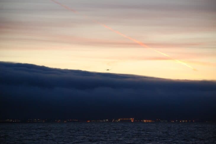
SFO reported a cloud ceiling below 1,000 feet in 541 hours of 2025, but surface fog in only 16. The FAA handbook says fog differs from a cloud only in that its base is at the ground. When the gray deck hangs over the runways instead of sitting on them, the METAR codes it as cloud.
San Francisco International logged the fewest hours of either: 172 of mist and 16 of fog, or 10.8 mist hours for every hour of fog.
Takeaway: mist is the everyday condition and fog the rarer, thicker one, even on coasts famous for fog.
The difference in one sentence
Fog and mist are the same suspended water droplets, and a weather report calls it fog when you can see less than 5/8 mile (1 km) and mist when you can see farther, up to 7 miles in the US or about 3 miles abroad.
FAQ
Sources and references used for research and fact-checking.
- WMO International Cloud Atlas, Fog compared with Mist
- WMO International Cloud Atlas, Fog (Section 3.2.1.1.1)
- Federal Aviation Administration, Aviation Weather Handbook (FAA-H-8083-28B)
- National Weather Service, NWS Glossary: Mist
- National Weather Service, NWS Glossary: Fog and Dense Fog Advisory
- Met Office, Mist, fog, and haze: What's the difference?
- BBC Weather, Mist and fog: what's the difference?
- Civil Aviation Authority of New Zealand, Code for significant present and forecast weather at the aerodrome
- eCFR, 14 CFR 91.155 Basic VFR weather minimums
- eCFR, 14 CFR 91.157 Special VFR weather minimums
- Iowa Environmental Mesonet, Iowa State University, ASOS-AWOS-METAR data download
- Wikipedia, METAR
Get the Newsletter
The latest aviation news and stories sent to your inbox.
About the Author

Tim is the owner and lead editor of AeroCorner since 2019, overseeing aviation content covering aircraft, airlines, airports, and the broader aviation industry. Through years of researching, writing, editing, and publishing aviation-focused content, he has developed extensive practical knowledge of commercial aviation and air travel. Based in Asia and a frequent traveler himself, Tim also brings firsthand passenger experience to AeroCorner’s coverage. Outside of publishing, he has also explored aviation firsthand through hands-on flight training in New Zealand.