


Table of Contents
A METAR is an airport’s routine weather report: a coded snapshot of the wind, visibility, weather, clouds, temperature and pressure observed at that airport, usually issued once an hour. The FAA calls it an Aviation Routine Weather Report.
It is an observation, not a forecast. It tells a pilot what the sky is doing at the field right now, in a fixed order that reads the same at every airport in the country.
Here is a real one from Denver International, issued on the morning of September 28, 2026, decoded group by group:
METAR KDEN 281153Z 18018G26KT 10SM FEW110 SCT150 BKN250 17/08 A3002 RMK AO2 PK WND 18027/1135 SLP087 T01670083 10189 20167 56013 $
| Group | Code | What it means |
|---|---|---|
| Report type | METAR | Routine scheduled report (SPECI would mean an unscheduled one) |
| Station | KDEN | Four-letter ICAO code: Denver International Airport |
| Date and time | 281153Z | 28th of the month, 11:53 UTC (Zulu) |
| Wind | 18018G26KT | From 180 degrees true at 18 knots, gusting to 26 knots |
| Visibility | 10SM | 10 statute miles or more |
| Sky condition | FEW110 SCT150 BKN250 | Few clouds at 11,000 feet, scattered at 15,000 feet, broken at 25,000 feet (the ceiling) |
| Temperature / dew point | 17/08 | 17°C (63°F) with a dew point of 8°C (46°F) |
| Altimeter | A3002 | Altimeter setting of 30.02 inches of mercury |
| Remarks | RMK AO2 … $ | Station type, peak wind, sea-level pressure, precise temperatures, pressure trend and a maintenance flag (decoded below) |
What METAR actually stands for
The FAA’s official name is Aviation Routine Weather Report, and the National Weather Service spells it out as METeorological Aerodrome Report. The version you often see online, Meteorological Terminal Air Report, is an informal expansion: it does not appear in the FAA’s weather chapter of the Aeronautical Information Manual, its Aviation Weather Handbook or the federal observing handbook.
What is a METAR in aviation?
A METAR is the standard format for a surface weather observation at an airport. In the US, many are produced by automated sensors, the ASOS and AWOS stations that sit beside the runways, and others are taken or checked by a trained human observer.
For a pilot, it answers the first question of any weather briefing: what is actually happening at the airport? Forecasts come next, and comparing the two shows whether the forecast is holding up.
How to read a METAR, group by group
A US METAR has two parts: a body of up to 11 groups and a remarks section. The groups always come in the same order, and when an element does not occur or cannot be observed, its group is simply left out.
The order, per the FAA: report type, station, date and time, modifier, wind, visibility, runway visual range, weather, sky condition, temperature and dew point, altimeter, then remarks.
Report type and station
METAR marks the routine scheduled report. SPECI marks a special, unscheduled report made because the weather changed significantly between hours (more on that below).
The station is the four-letter ICAO code. In the lower 48 states it is the familiar three-letter airport code with a K in front, so KDEN is Denver and KORD is Chicago O’Hare.
Date and time
Six digits and a Z: the day of the month, then the hour and minute in UTC, which pilots call Zulu time. 281153Z is the 28th at 11:53 UTC, or 5:53 a.m. in Denver.
Routine observations are taken a few minutes before the hour. Under the federal observing handbook, a report stamped 1153Z is the 1200Z routine report.
Modifier: AUTO and COR
AUTO means the report is fully automated, with no human oversight. When AUTO is missing, the report was made by an observer or an automated report had a person augmenting or backing it up.
COR means the report is a correction of one already sent. It takes the place of AUTO in the same slot.
Wind
The first three digits are the direction the wind is blowing from, in degrees relative to true north, averaged over two minutes. The next two or three are the speed in knots, so 27020KT is a west wind at 20 knots.
A G adds the gust: 18018G26KT is 18 knots gusting to 26. VRB03KT means a light, variable wind, and 00000KT means calm.
When the direction swings by 60 degrees or more at a speed above 6 knots, a second group gives the range: 21010KT 180V240 is a 10-knot wind varying between 180 and 240 degrees.
The METAR wind and the tower's wind are not the same number
A METAR reports wind relative to true north. The wind a control tower issues is magnetic, and so is the automated weather station’s own voice broadcast, because runways are numbered by magnetic heading. Where true and magnetic north sit far apart, the same wind reads noticeably differently in the text report and on the radio.
So before comparing a METAR wind with the runway in use, the one announced on the airport’s ATIS broadcast, allow for the gap between true and magnetic north.
Visibility and runway visual range
US reports give visibility in statute miles, always ending in SM. Fractions are written out, so 1 1/2SM is a mile and a half, and M1/4SM means less than a quarter mile.
Automated stations top out at 10SM, which means 10 miles or more. Most other countries report visibility in meters instead.
When visibility drops to 1 statute mile or less, or the runway visual range on the instrument runway falls to 6,000 feet or less, a station with RVR equipment adds it. R28L/2400FT means 2,400 feet of visual range down runway 28 Left.

Weather: RA, BR, TS and the rest
The weather group stacks an intensity, an optional descriptor and the phenomenon. A minus sign means light, no sign means moderate and a plus sign means heavy, so -TSRA is a thunderstorm with light rain and +SN is heavy snow.
| Code | Meaning | Code | Meaning |
|---|---|---|---|
| RA | Rain | TS | Thunderstorm |
| DZ | Drizzle | SH | Showers |
| SN | Snow | FZ | Freezing |
| GR | Hail, 1/4 inch or larger | BL | Blowing |
| GS | Small hail or snow pellets | VC | In the vicinity (5 to 10 miles away in the US) |
| PL | Ice pellets | HZ | Haze |
| UP | Unknown precipitation (automated stations) | FU | Smoke |
| BR | Mist, visibility 5/8 to 6 miles | SQ | Squall |
| FG | Fog, visibility under 5/8 mile | +FC | Tornado or waterspout |
The difference between BR and FG trips up a lot of readers. The federal observing handbook defines both as visible droplets of water suspended in the air; the code depends on how far you can see, a distinction covered in more depth in our guide to the types of fog in aviation.
Sky condition and the ceiling
Each cloud layer gets a coverage code and a height. The height is three digits in hundreds of feet above ground level, not above sea level, so BKN025 is a broken layer at 2,500 feet over the airport.
| Code | Meaning | Sky covered |
|---|---|---|
| SKC / CLR | Clear (CLR: automated, nothing detected at or below 12,000 feet) | 0 |
| FEW | Few | 1/8 to 2/8 |
| SCT | Scattered | 3/8 to 4/8 |
| BKN | Broken (counts as a ceiling) | 5/8 to 7/8 |
| OVC | Overcast (counts as a ceiling) | 8/8 |
| VV | Vertical visibility into an obscured sky (counts as a ceiling) | 8/8 |
The ceiling is the lowest layer reported as broken or overcast, or the vertical visibility when the sky is totally obscured. In the Denver example, the ceiling is the broken layer at 25,000 feet.
A CLR from an automated station does not promise a clear sky. It means the sensor found nothing at or below 12,000 feet, and there may be cloud above that.
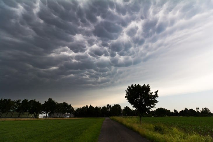
At stations with an observer, a layer can carry a cloud-type tag: CB for cumulonimbus, the thunderstorm cloud, or TCU for towering cumulus. SCT015TCU is a scattered layer of towering cumulus at 1,500 feet. Our guide to cloud types in aviation covers why pilots treat those two with respect.
Temperature, dew point and altimeter
Temperature and dew point are whole degrees Celsius, separated by a slash. An M means minus, so 04/M02 is 4°C with a dew point of -2°C.
Pilots watch the gap between the two. As the spread shrinks toward zero the air nears saturation, which is why a narrowing spread is an early fog warning.
The last body group is the altimeter setting. In the US it starts with A and gives inches of mercury, so A3002 is 30.02, the number a pilot dials into the altimeter so it reads the right altitude.
METAR remarks decoded: AO2, SLP, T-groups and the $ sign
Everything after RMK is remarks. They add detail to the body, and many exist mainly for the weather record, but a few matter to pilots.
Here is what each remark in the Denver report means:
- AO2: an automated station with a precipitation discriminator, meaning it can tell rain from snow. AO1 is a station without one.
- PK WND 18027/1135: the peak wind since the last report, 27 knots from 180 degrees at 11:35 UTC. It is added when the peak tops 25 knots.
- SLP087: sea-level pressure of 1008.7 hectopascals (millibars). The leading 10 or 9 is dropped and has to be inferred.
- T01670083: temperature 16.7°C and dew point 8.3°C, in tenths of a degree. A 1 in front of either value would mean below zero.
- 10189 and 20167: the highest and lowest temperatures of the past six hours, 18.9°C and 16.7°C.
- 56013: the three-hour pressure tendency. The 6 says pressure is lower than three hours ago after falling and then leveling off or slowing, and 013 is a change of 1.3 hectopascals.
- $: the maintenance indicator. The automated system has detected that it needs maintenance.
The $ sign causes more confusion than any other character in a METAR. According to the ASOS User’s Guide, it means maintenance may be needed but does not necessarily mean the data are wrong.
Denver’s reports that morning carried the $ through 12:53 UTC, and it was gone from the next report an hour later.
Other remarks you will meet often: RAB05 (rain began at five past the hour), TSB03 and TSE30 (thunderstorm began and ended), P0009 (0.09 inch of precipitation in the past hour), PRESFR (pressure falling rapidly) and TSNO (the lightning sensor is out of service).
What is a SPECI?
A SPECI is an unscheduled METAR, issued as soon as possible when the weather crosses a threshold between the hourly reports. It uses the same format, with SPECI in place of METAR.
The triggers are specific. Under the FAA’s criteria, a SPECI goes out when, among other events:
- Visibility drops below, or rises back to, 3, 2, 1, 1/2 or 1/4 mile, or the lowest instrument approach minimum.
- A ceiling forms, disappears or crosses 3,000, 1,500, 1,000 or 500 feet.
- A thunderstorm begins or ends, or a tornado, funnel cloud or waterspout is seen.
- The wind shifts 45 degrees or more in under 15 minutes while blowing at 10 knots or more.
- Hail begins or ends, or freezing precipitation begins, ends or changes intensity.
So a SPECI is not only about weather going below basic VFR minimums. Those 3-mile and 1,000-foot values are on the list, but so are thresholds well below them that matter for instrument approaches.
How US and international METARs differ
METAR is an international code, but the US version has its own habits. A pilot reading a European report for the first time will meet meters, hectopascals and a few codes US stations never send.
| Element | US METAR | Typical international METAR |
|---|---|---|
| Visibility | Statute miles: 10SM | Meters: 9999 means 10 km or more |
| Runway visual range | Feet | Meters |
| Altimeter | Inches of mercury: A3002 | Hectopascals: Q1019 |
| CAVOK | Not part of the US format | Replaces visibility, weather and cloud groups in good weather |
| Trend forecast | None | NOSIG, TEMPO or BECMG covering the next 2 hours |
| How often | Hourly, plus SPECIs | Hourly or half-hourly |
Frankfurt’s report from the same day shows several of them at once: METAR EDDF 281520Z AUTO 36005KT 320V030 CAVOK 27/10 Q1019 NOSIG.
CAVOK (ceiling and visibility OK) stands in for the visibility, weather and cloud groups when visibility is 6 miles (10 km) or more, there is no cloud below 5,000 feet (1,500 m) or the minimum sector altitude if that is higher, no cumulonimbus and no significant weather. Our CAVOK and CAVU explainer covers how it compares with CAVU.
NOSIG does not mean "no significant weather"
NOSIG is short for no significant change. It is a two-hour trend forecast tacked onto the end of a METAR, saying the conditions just reported are expected to hold. It says nothing about whether those conditions are good, and you will not find it on a US report at all: the FAA notes that National Weather Service METARs exclude trend forecasts.
METAR vs TAF: what is the difference?
A METAR reports what is happening now. A TAF, or Terminal Aerodrome Forecast, predicts what will happen at the airport over a set period, covering the area within 5 statute miles of the center of the runway complex.
The National Weather Service issues TAFs for nearly 700 US airports. Most cover 24 hours, some major airports get 30, and the scheduled ones go out four times a day, at 0000, 0600, 1200 and 1800Z.
Here is the first part of Denver’s TAF from the same morning:
TAF KDEN 281459Z 2815/2918 19012G17KT P6SM BKN160 BKN220 FM281700 22011G18KT P6SM SCT090 BKN120 FM282000 20014G23KT P6SM -SHRA BKN080 OVC120
The groups look familiar, but two things are new. 2815/2918 is the valid period, 15:00 UTC on the 28th to 18:00 UTC on the 29th, and each FM group starts a new forecast period, so FM282000 brings light rain showers from 20:00 UTC.
P6SM means visibility better than 6 statute miles, the TAF’s way of saying unrestricted. A US TAF also leaves out temperature, which a METAR always carries.
How often are METARs issued, and how long are they valid?
US stations issue a routine METAR every hour, taken a few minutes before the top of the hour, plus a SPECI whenever the weather crosses a threshold in between. Many airports abroad report every 30 minutes; Heathrow, Schiphol, Paris Charles de Gaulle and Frankfurt all did on the day of these examples.
A METAR has no official expiry time in FAA guidance, because it is an observation rather than a forecast. It describes the moment it was taken and stays the latest word until the next report replaces it.
In practice that is up to an hour. The National Weather Service describes METARs as valid weather information for one hour, but a SPECI can replace one within minutes when the weather is changing fast.
Where to get METARs (and what happened to ADDS)
The official US source is the Aviation Weather Center at aviationweather.gov, which shows raw and decoded METARs and TAFs for airports worldwide. Flight-planning apps and airport pages pull from the same data.
Many pilots still search for “ADDS METAR.” ADDS, the Aviation Digital Data Service that NOAA and the FAA created together, is gone: the Aviation Weather Center overhauled its site in October 2023, replaced the old ADDS graphics and succeeded its text data server with a new Data API.
The FAA’s printed reference moved too. The old advisory circular AC 00-45H, Aviation Weather Services, was cancelled in December 2022 and folded into the Aviation Weather Handbook, whose current edition, FAA-H-8083-28B, was published in April 2026.
A short history of the METAR
The METAR code was first developed in 1968 as an international standard for airport weather reports. The US kept its own domestic format for almost three decades after that.
That changed on July 1, 1996, at 0800 UTC, when the National Weather Service switched to METAR and TAF. The domestic SA surface observation code and FT terminal forecast code were discontinued the same day, and US reports have used the international structure, with American units, ever since.
FAQ
Sources and references used for research and fact-checking.
- FAA, Aeronautical Information Manual, Chapter 7, Section 1: Meteorology
- FAA, Aviation Weather Handbook (FAA-H-8083-28B), 2026
- Office of the Federal Coordinator for Meteorology (NOAA), Federal Meteorological Handbook No. 1: Surface Weather Observations and Reports (2019)
- NOAA / National Weather Service, Automated Surface Observing System (ASOS) User's Guide
- National Weather Service, What's a METAR?
- FAA, Aeronautical Information Manual, Chapter 4, Section 3 (4-3-6 Use of Runways)
- National Weather Service, Aviation Digital Data Service (ADDS) brochure
- NOAA Aviation Weather Center, Aviation Weather Center help and FAQ
- NOAA Aviation Weather Center, METAR data
- FAA, AC 00-45H, Aviation Weather Services (status page)
- National Weather Service (via Unidata archive), Technical Information Message 96-14: US implementation of METAR and TAF
Get the Newsletter
The latest aviation news and stories sent to your inbox.
About the Author

Matt Claiborne is an FAA Airline Transport Pilot and Certified Flight Instructor with more than two decades of experience in flight training. He has served as an assistant professor and FAA Part 141 Assistant Chief Instructor for a university aeronautics program in Florida. His background in professional flying, flight instruction, and aviation education gives him firsthand expertise in aircraft operations, pilot training, flight procedures, and aviation safety.