


Table of Contents
A nautical mile is 1.1508 statute miles: 6,076 feet (1,852 m), against the 5,280 feet (1,609 m) of an ordinary mile. That makes the nautical mile about 15% longer.
The two units exist for different reasons. The statute mile is a legal length, inherited from Roman marching paces and fixed by an English Act of Parliament. The nautical mile is tied to the planet itself: it is one minute of latitude, one sixtieth of a degree.
That link to the Earth’s grid is why ships and aircraft use it. A navigator can measure distance straight off the latitude scale of a chart, and speed follows directly, because a knot is simply one nautical mile per hour.
| Statute mile | Nautical mile | |
|---|---|---|
| Length in feet | 5,280 ft | 6,076.12 ft |
| Length in meters | 1,609.344 m (exact) | 1,852 m (exact) |
| In the other unit | 0.869 nautical miles | 1.1508 statute miles |
| Based on | 8 furlongs, set in English law in 1593 | 1 minute of latitude |
| Current definition since | 1959 international yard and pound agreement | 1929 International Hydrographic Conference |
| Speed unit | Miles per hour (mph) | Knot (nautical miles per hour) |
| Symbol | mi, SM | NM, nmi |
| Used for | Road distance, US flight visibility | Air and sea navigation, territorial waters |
What is a statute mile?
The statute mile is the mile on American road signs and car odometers: 5,280 feet, or 1,760 yards. It takes its name from the statute that defined it.
Its ancestor is the Roman mile, the mille passus, or a thousand paces counted every other step. That came to 5,000 Roman feet, roughly 4,850 feet (1,479 m), noticeably shorter than today’s mile.
In 1593, an Act of Parliament under Elizabeth I fixed the English mile at eight furlongs, each of 40 poles. Tying the mile to the furlong rather than to the Roman foot is what produced the odd figure of 5,280 feet.
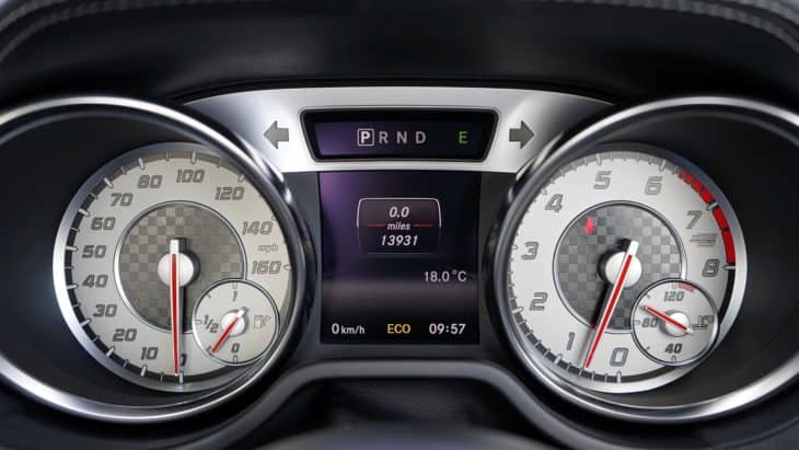
The last loose end was tied up in 1959, when the international yard and pound agreement fixed the foot at exactly 0.3048 meters. That made the statute mile exactly 1,609.344 meters in the US, the UK, Canada, Australia, New Zealand, and South Africa.
The United States kept a fractionally longer survey foot, and with it a survey mile, for land surveying for decades afterward. NIST declared the US survey foot obsolete on January 1, 2023, so there is now one American mile.
What is a nautical mile?
A nautical mile is the distance covered by one minute of arc along a meridian, the north-south line running from pole to pole. Every degree of latitude holds 60 minutes, so every degree of latitude is 60 nautical miles.
Scale that up and the whole planet falls into round numbers. A full circle through both poles is 360 degrees of 60 minutes each, which comes to about 21,600 nautical miles.

The catch is that the Earth is not a perfect sphere. It is slightly flattened at the poles, so a minute of latitude runs about 6,047 feet (1,843 m) at the equator and about 6,109 feet (1,862 m) near the poles.
Countries once settled that spread in different places. Britain’s Admiralty mile was 6,080 feet, and the pre-1954 US nautical mile was 6,080.2 feet.
In 1929, the First International Extraordinary Hydrographic Conference in Monaco ended the confusion by defining the international nautical mile as exactly 1,852 meters. The United States adopted it in 1954 and Britain in 1970.
The nautical mile and the kilometer are siblings
In 1791, France defined the meter as one ten-millionth of the distance from the North Pole to the equator. That quarter of a meridian is 90 degrees, or 5,400 minutes of latitude. Divide 10,000 kilometers by 5,400 and you get 1,851.85 meters, which rounds to the 1,852-meter nautical mile used today.
Why latitude, and not longitude?
Lines of latitude, called parallels, stay the same distance apart everywhere on Earth. Lines of longitude, called meridians, converge toward the poles, and the FAA’s pilot handbook tells student pilots to measure courses near the middle of a route for exactly that reason.
A minute of longitude is a full nautical mile wide only at the equator. At 60 degrees north it has shrunk to about half a nautical mile, and at the pole it is zero.
A minute of latitude, by contrast, is always close to one nautical mile. That is what turns the latitude scale on the edge of any chart into a ready-made ruler.
Why pilots and sailors use nautical miles instead of miles
Navigation works in angles. Positions are latitude and longitude, courses are degrees, and the shortest route between two airports is measured as great circle distance, an arc across the globe.
A unit built on the same angles removes a whole layer of conversion, because one degree of any great circle is 60 nautical miles. It is also why flights across the Pacific look curved on a flat map while flying the shortest line on the globe.
Paper charts are built around it. A standard VFR sectional chart has a scale of 1:500,000, where one inch equals 6.86 nautical miles, or about 8 statute miles, and a pilot’s plotter carries a ruler in both units.
The avionics speak it too. Distance measuring equipment (DME) reports slant range to a ground station in nautical miles, so an aircraft passing directly over a VORTAC, a VOR navigation beacon paired with distance equipment, at 6,076 feet above the ground reads about 1.0 NM: one nautical mile, straight down.
At sea, the unit came first. Aviation borrowed it from marine navigation along with the charts, and today the nautical mile is the standard unit of length for air, marine, and space navigation.
Nautical miles vs knots: what is a knot?
A knot is a speed, not a distance: one nautical mile per hour, or about 1.15 mph (1.852 km/h). Saying “knots per hour” counts the hour twice, like saying “mph per hour.”
The name dates from the 17th century, according to NOAA. Sailors let a wooden “common log” float off the stern on a line knotted at even intervals, waited a set time, then counted how many knots had run out.
Later chip logs spaced the knots 47 feet 3 inches apart and timed the run with a 28-second sandglass. The ratio was no accident: 47.25 feet in 28 seconds is 1.69 feet per second, which is one knot.
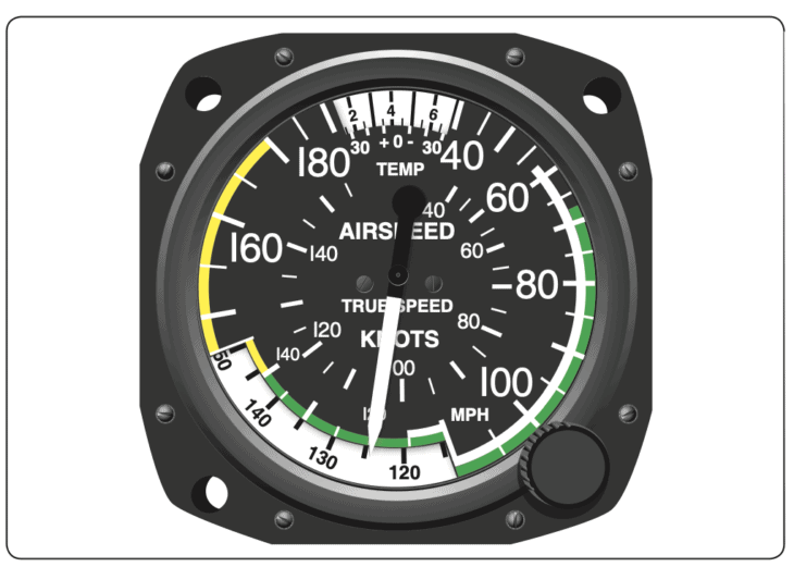
Knots run through modern flying. The number on the airspeed indicator is usually KIAS, knots indicated airspeed, and the National Weather Service reports surface winds and winds aloft in knots.
The rules are written in knots too. The FAA caps speed below 10,000 feet at 250 knots, which the regulation itself glosses as 288 mph, and at 200 knots (230 mph) beneath busy Class B airspace.
Higher up, jets fly by Mach number instead, a speed that is not a fixed number of knots at all. When two sources quote different airplane speeds, check the unit first: 500 knots and 575 mph are the same speed.
Where US aviation still uses statute miles
The statute mile has not left the cockpit. In the United States, flight visibility is measured in statute miles: the FAA’s VFR weather minimums require 3 statute miles in Class B airspace and 1 statute mile in Class G airspace near the ground by day.
Some airspeed indicators are still calibrated in mph, too, which is why the FAA’s pilot handbook teaches student pilots to multiply knots by 1.15. Its own example: a 20-knot wind is 23 mph.
So a US pilot can be flying in knots, navigating in nautical miles, and checking visibility in statute miles, all on the same flight.
The 15% trap
Airliner and business jet ranges are usually published in nautical miles. Quote a 3,000-nautical-mile range as 3,000 miles and you have quietly shaved about 450 miles (725 km) off it. Before converting any aircraft spec, check which mile the spec sheet means.
Nautical miles at sea: the 12-mile limit
Nautical miles also draw the borders at sea. Under the UN Convention on the Law of the Sea, a country may claim territorial waters up to 12 nautical miles, about 13.8 miles (22.2 km), from its baseline.
Beyond that sit a contiguous zone reaching 24 nautical miles and an exclusive economic zone reaching 200 nautical miles, about 230 miles (370 km). Inside that zone, the coastal state controls fishing, mining, and oil exploration.
The 12-mile figure is a compromise. For centuries the limit was the reach of a cannon shot, adopted as 3 nautical miles by Britain and the United States, and only the UNCLOS III talks of 1973 to 1982 settled on 12.
Nautical miles to miles and kilometers: conversion chart
The formulas are simple. Multiply nautical miles by 1.1508 to get statute miles, or by 1.852 to get kilometers. To go the other way, multiply statute miles by 0.869: 10 miles is 8.69 nautical miles.
For mental math, add 15%. 100 nautical miles is about 115 miles, and 200 knots is about 230 mph. For any other figure, our aviation unit converter handles nautical miles in both directions.
| Nautical miles | Statute miles | Kilometers |
|---|---|---|
| 1 | 1.15 | 1.85 |
| 5 | 5.75 | 9.26 |
| 10 | 11.51 | 18.52 |
| 12 | 13.81 | 22.22 |
| 20 | 23.02 | 37.04 |
| 50 | 57.54 | 92.60 |
| 100 | 115.08 | 185.20 |
| 200 | 230.16 | 370.40 |
| 250 | 287.69 | 463.00 |
| 500 | 575.39 | 926.00 |
| 1,000 | 1,150.78 | 1,852.00 |
| 5,000 | 5,753.90 | 9,260.00 |
| Knots | Miles per hour | Kilometers per hour |
|---|---|---|
| 10 | 11.5 | 18.5 |
| 20 | 23.0 | 37.0 |
| 30 | 34.5 | 55.6 |
| 40 | 46.0 | 74.1 |
| 50 | 57.5 | 92.6 |
| 100 | 115.1 | 185.2 |
| 200 | 230.2 | 370.4 |
| 250 | 287.7 | 463.0 |
| 300 | 345.2 | 555.6 |
| 500 | 575.4 | 926.0 |
FAQ
Sources and references used for research and fact-checking.
- Wikipedia, Nautical mile
- Wikipedia, Mile
- NOAA National Ocean Service, What is the difference between a nautical mile and a knot?
- NOAA National Ocean Service, Currents tutorial: measuring currents
- Wikipedia, Knot (unit)
- NIST, U.S. Survey Foot
- Federal Aviation Administration, Pilot's Handbook of Aeronautical Knowledge, Chapter 16: Navigation
- Legal Information Institute, Cornell Law School, 14 CFR 91.155: Basic VFR weather minimums
- Legal Information Institute, Cornell Law School, 14 CFR 91.117: Aircraft speed
- United Nations, United Nations Convention on the Law of the Sea, Part II
- Wikipedia, Territorial waters
Get the Newsletter
The latest aviation news and stories sent to your inbox.
About the Author

Matt Claiborne is an FAA Airline Transport Pilot and Certified Flight Instructor with more than two decades of experience in flight training. He has served as an assistant professor and FAA Part 141 Assistant Chief Instructor for a university aeronautics program in Florida. His background in professional flying, flight instruction, and aviation education gives him firsthand expertise in aircraft operations, pilot training, flight procedures, and aviation safety.