

Table of Contents
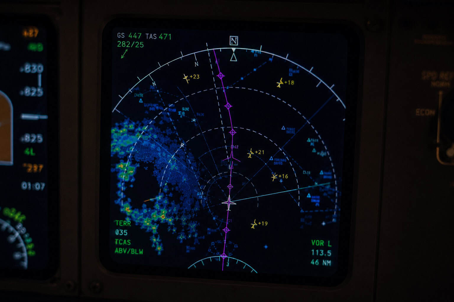
You are settled into cruise, seatback screen showing a little aircraft crawling along a dotted line toward your destination. Then the line bends. The aircraft makes a turn that was not on the map, tracks sideways for a few minutes, and resumes its general direction a different way. Nobody announces anything. The flight attendants are not concerned. What just changed?
The route displayed on the map when you board is the filed route: the path the dispatcher and airline submitted to air traffic control before departure. It is rarely the route the aircraft actually flies. Between the moment a flight plan is submitted and the moment the aircraft touches down, the route can be amended by ATC multiple times, for reasons ranging from thunderstorms crossing the original path to a military exercise activating restricted airspace to a controller simply offering a more direct line when traffic clears. The filed route is less a commitment and more a starting proposal.
Understanding how routes are built, issued, and changed in real time requires understanding a system most passengers have never heard of: the airway network that covers the sky like an invisible road map, the departure and arrival procedures that connect airports to that network, and the clearance that hands your flight its specific path before the engines spool up.
The clearance that starts everything
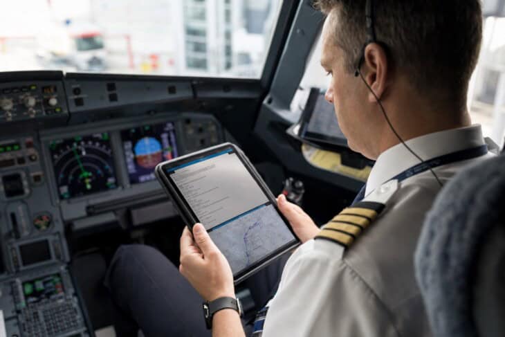
Before a commercial flight can depart under instrument flight rules, which govern all scheduled airline operations regardless of the weather, the crew must receive and read back an IFR clearance from ATC. This clearance is the formal authorisation to enter controlled airspace and follow a specific route. Pilots use the acronym CRAFT to organise what they are listening for: the Clearance limit (almost always the destination airport), the Route (the specific path authorised, including any waypoints, airways, or standard procedures), the Altitude (the initial assigned altitude and any expected higher clearance), the Frequency (the departure control frequency to contact after takeoff), and the Transponder code (the four-digit squawk that makes the aircraft visible to radar).
The route element of the clearance is where things get interesting. Airlines file preferred routes, published paths that ATC uses most frequently for a given city pair, because flights filed on known preferred routes are more likely to receive that route without amendment. A flight from New York to Chicago, for example, has well-established preferred routing that hundreds of flights follow every day. But the clearance may not match the filed route exactly. ATC may substitute a different departure procedure, issue a revised routing due to current traffic or weather, or clear the flight direct to a fix much further along the route than the filed plan specified. The crew acknowledges whatever they receive, reads it back to confirm, and that becomes the legal flight plan.
The highway system in the sky
The route in the clearance is built from a published network of airways that covers the airspace like a road system. In the United States, the low-altitude network, used below 18,000 feet, consists mainly of Victor airways: corridors defined by lines between VHF omnidirectional range (VOR) ground stations, each one identified by a number prefixed with V, like V23 or V105. Above 18,000 feet, where virtually all commercial jet traffic operates, the high-altitude network consists of Jet routes, prefixed with J, and a growing number of RNAV routes, prefixed with Q, that use GPS satellite navigation instead of ground-based stations. RNAV routes tend to be more direct because they are not constrained by the locations of VOR transmitters, which were sited decades ago for reasons that no longer apply to GPS-equipped aircraft.
At each end of the en-route phase, the airway system connects to the airport environment through published procedures. Departures follow a Standard Instrument Departure, known as a SID: a predefined path that takes an aircraft from the runway through the busy terminal airspace and onto the en-route structure, with specific waypoints, altitudes, and speed restrictions already built in. Without SIDs, every departing flight would require individual instructions from controllers to clear the terminal area, a level of radio traffic that would overwhelm busy facilities. Instead, a controller can clear an aircraft to follow a named SID in a single short transmission, and both the crew and the controller know exactly what that means. Arrivals work the same way in reverse, via Standard Terminal Arrival Routes, known as STARs, which funnel aircraft from cruise altitude down to the initial approach fix at the destination airport along a predefined path.
Together, the SID, the en-route airways, and the STAR form the backbone of the route in the clearance. For a two-hour domestic flight, the full route might read as a departure procedure name, followed by a sequence of airways and waypoints, followed by an arrival procedure name and a destination. Experienced crews load this into the flight management computer before departure. The aircraft essentially knows where it is going before it leaves the gate.
The airway structure at a glance
Victor airways (V-routes): Low-altitude airways below 18,000 feet, defined by lines between VOR ground stations. Mostly used by smaller aircraft.
Jet routes (J-routes): High-altitude airways from 18,000 feet to FL450, the primary structure for commercial jet traffic. Also VOR-based.
RNAV routes (Q and T routes): GPS-based airways, more direct than VOR routes because they are not constrained by ground station locations. Increasingly the preferred option for modern jet operations.
SIDs and STARs: Predefined published procedures connecting airports to the en-route airway system at each end of the flight, reducing the need for individual ATC instructions in the busy terminal environment.
Why the map changes in flight
Once airborne, the route in the clearance is not fixed. ATC can amend it at any time, and on a typical commercial flight they will. The most common amendment is also the most welcome: “proceed direct,” followed by a waypoint much further along the route than the aircraft’s current position. This shortcut collapses several intermediate waypoints into a straight line, cutting distance and saving fuel. It happens when traffic ahead has cleared, when the aircraft is performing better than forecast and has reached a point earlier than the flow expected, or simply because the controller has a window in the traffic and offers the faster routing. Airlines track these direct clearances as a measure of efficiency. A flight that receives several “proceed direct” clearances during a cross-country sector may arrive noticeably ahead of schedule.
The amendments that are not welcome are those driven by weather. A line of thunderstorms sitting across the filed route requires a deviation, either around the cells or through a gap that ATC and the crew agree is wide enough. ATC may issue a reroute on the ground before departure, or the crew may request a deviation en route. Military airspace is another common cause of route changes: certain blocks of airspace are designated as Military Operations Areas and are restricted when active. When they are active, aircraft must be routed around them. When they are inactive, which varies by time of day and day of week, ATC can offer the aircraft a direct crossing that would otherwise not be available. A crew that filed around a Military Operations Area expecting it to be active may receive a significant shortcut if it turns out to be cold.
American Airlines Flight 965, December 20, 1995
On approach to Cali, Colombia, the crew of American Airlines Flight 965 accepted an ATC offer of direct routing to the ROZO beacon, a shortcut that would save time on an already late arrival. When the first officer searched for “R” in the flight management computer, the system returned ROMEO, a different fix near Bogota, hundreds of miles away. The crew selected it without verifying the distance or bearing. The aircraft turned toward the mountains of the Cordillera Central. The crew recognised the error too late.
The Boeing 757 struck Mount El Deluvio at 9,000 feet. Of 163 people on board, 160 died. The accident became a landmark case in the study of flight management computer interface design and the dangers of accepting position-shortening clearances without careful verification. Direct routing saves time and fuel. It also compresses the workload at exactly the moment the crew is busiest.
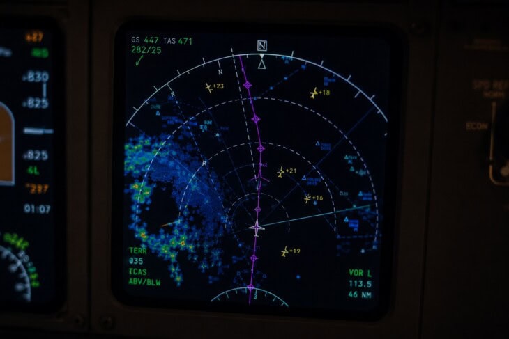
The route your flight actually flies is the product of a plan made hours before departure, modified by a clearance issued minutes before takeoff, and then amended in real time by controllers responding to weather, traffic, and opportunity. The filed route is the starting point, not the destination. The system that decides when to hold those routes, delay departures, or reroute entire streams of aircraft before they even leave the ground is covered in the article on ground stops and flow control, which explains the traffic management layer that operates above the individual controller. For the full picture of how these clearances sit within the broader ATC system, the How Air Traffic Control Actually Works series covers each piece in turn. The role of the airline dispatcher in building the filed route before any of this begins is covered in the companion series, in the article on the airline flight dispatcher.
FAQ
Sources and references used for research and fact-checking.
- CRAFT Explained: IFR Made Simple for Pilots - Pilot Institute
- AIM § 5-3-4: Airways and Route Systems - FAA Aeronautical Information Manual
- SIDs and STARs - SKYbrary Aviation Safety
- Victor airways - Wikipedia
- Routes, Reroutes, and Severe Weather Avoidance Plan (SWAP) - NBAA
- Why the Quickest Flight Route Might Not Always Be the Obvious One - The Points Guy
- FAA Activates Scores of New, Faster Routes Along East Coast - Federal Aviation Administration
- American Airlines Flight 965 accident - Wikipedia / NTSB records
Get the Newsletter
The latest aviation news and stories sent to your inbox.
About the Author
Tim is the owner and lead editor of AeroCorner since 2019, overseeing aviation content covering aircraft, airlines, airports, and the broader aviation industry. Through years of researching, writing, editing, and publishing aviation-focused content, he has developed extensive practical knowledge of commercial aviation and air travel. Based in Asia and a frequent traveler himself, Tim also brings firsthand passenger experience to AeroCorner’s coverage. Outside of publishing, he has also explored aviation firsthand through hands-on flight training in New Zealand.