


Table of Contents
There is a moment on most transatlantic flights when the moving map on your seatback screen stops showing familiar airways and city names. The aircraft is somewhere over the North Atlantic, it is probably the middle of the night, the cabin is dark, and the ocean below contains no airports, no landmarks, and no ground-based radar. If something went wrong with your aircraft right now, or with an aircraft a hundred miles ahead at the same altitude, who would know?
The answer is a team of controllers working at facilities you have almost certainly never heard of, using a system that combines decades-old radio technology, a network of commercial satellites, and a twice-daily planning process designed around the movement of the jet stream. The North Atlantic is the busiest oceanic airspace on the planet, with roughly 1,500 flights crossing it every day. Managing it with no radar is not a workaround. It is the result of sixty years of procedural engineering, and it works.
Where radar ends
VHF radio, the frequency band used for most air traffic control communications, travels in straight lines. It passes through buildings and weather systems but it cannot curve around the Earth. At cruising altitude, a VHF signal can reach roughly 200 nautical miles before the horizon cuts it off. Over an ocean three times that width at its narrowest, there is no practical way to use ground-based VHF radio to talk to aircraft, and no way to use ground-based radar to track them.
The airspace above the North Atlantic is divided among six Oceanic Control Areas, each managed by a different national air navigation service provider. The two that handle most of the traffic are Gander Oceanic, operated by NAV CANADA from a facility in Gander, Newfoundland, and Shanwick Oceanic, operated jointly by the UK’s NATS and Ireland’s IAA from a facility in Prestwick, Scotland. The boundary between their areas of responsibility runs along 30 degrees west longitude, roughly halfway across the ocean. New York Oceanic manages the airspace off the US and Canadian East Coast before flights pass into Gander’s area heading east, and Santa Maria Oceanic covers traffic approaching from the Azores to the south.
The coverage area is enormous. Gander’s Oceanic Control Area alone spans about 905 nautical miles north to south. Controllers at Shanwick and Gander cannot see their traffic on a radar scope the way a domestic approach controller can. What they have instead is a combination of procedural separation, high-frequency radio communication, datalink systems, and, since 2019, real-time surveillance from satellites in orbit. The procedural layer is what the whole system is built on.
The track system and the jet stream
To move 1,500 aircraft a day across an ocean with no radar, the route structure itself becomes the primary safety tool. The North Atlantic Organised Track System, known as the NAT or NAT-OTS, is a set of pre-planned routes published twice daily by the Gander and Shanwick facilities. Aircraft crossing the Atlantic are assigned a specific track, a specific altitude, and a specific Mach number, and they are expected to maintain all three precisely.
The tracks are not fixed. They are redrawn every twelve hours to follow the jet stream, a band of fast-moving high-altitude wind that shifts position and intensity depending on weather patterns. Tracks optimised for eastbound flights, from North America to Europe, are published around 1400 UTC for aircraft crossing 30 degrees west between 0100 and 0800 UTC, the window when transatlantic overnight departures are pushing east. Westbound tracks are published around 2200 UTC. An airline’s dispatcher studies the available tracks alongside the wind forecast and files the route that offers the best fuel economy. Catching a favorable jet stream at the right altitude can cut a transatlantic crossing by 30 to 40 minutes and save thousands of kilograms of fuel.
The tracks are labeled alphabetically and can vary significantly from one day to the next. The system also allows aircraft equipped for independent navigation to fly random routes outside the formal track structure, typically at altitudes where traffic density is lower. Most commercial long-haul flights use the organised tracks because they are specifically optimised for the current wind pattern, and the pre-planned structure makes ATC separation manageable at scale.
What an oceanic clearance actually specifies
Unlike a domestic IFR clearance, an oceanic clearance specifies a Mach number in addition to a track and flight level. Maintaining an assigned Mach number is how longitudinal spacing between aircraft on the same track is managed. If the aircraft ahead is flying Mach 0.84 and you are cleared at Mach 0.84, the gap stays constant. Both pilots copy the clearance independently and cross-check each other before entry. The aircraft must cross the oceanic entry point at exactly the assigned altitude and speed. A small error at the entry gate compounds into a significant position error over hours of flying in airspace where there is limited real-time awareness of where aircraft actually are.
Pilots request their oceanic clearance at least 40 minutes before reaching the oceanic entry point, typically via CPDLC datalink rather than voice. The clearance comes back from Gander or Shanwick specifying the approved track, level, and Mach number, which may differ from what the airline filed if traffic on the preferred track is too dense, or if a conflict exists with another aircraft at the requested level. An alternate track or altitude may be assigned. Once in oceanic airspace, crews cannot change course, altitude, or speed without explicit permission from the controlling facility.

What controllers could see, and what they can see now
Before satellite surveillance, oceanic controllers managed the NAT almost entirely on information that aircraft reported themselves. Pilots transmitted position reports over HF radio at each oceanic waypoint, giving controllers their only picture of where each flight was in real time. HF radio, which bounces off the ionosphere rather than traveling line-of-sight, can span thousands of miles, but it is notoriously noisy. It crackles, fades, and sometimes requires multiple attempts to get a readable transmission.
SELCAL, an acronym for Selective Calling, addressed one part of this problem. Each aircraft is assigned a unique four-character code. When controllers need to reach a specific flight, they transmit that code as two pairs of audio tones on the HF frequency. The matching aircraft triggers a chime and light in the cockpit, alerting the crew to make radio contact. For flight crews on a seven-hour overnight crossing, the ability to mute the HF static without missing a call from ATC is a meaningful operational benefit. SELCAL remains in use today.
Position reports and SELCAL defined oceanic surveillance for decades. They are reliable, but they have a fundamental limitation. A controller knows where an aircraft was at its last waypoint and where it should be at the next one, but not what is happening in between. If an aircraft deviates from its cleared altitude or track, controllers could wait ten to fourteen minutes before the discrepancy appears in a position report. In airspace where aircraft on parallel tracks may be separated by as little as 60 nautical miles laterally, an undetected deviation is a serious problem.
27 March 2019: the day oceanic surveillance changed
On 27 March 2019, NATS and NAV CANADA became the first air navigation service providers in the world to use space-based ADS-B for live oceanic traffic management. The Aireon system, hosted on the Iridium NEXT low-Earth orbit satellite constellation, provides position updates every 8 seconds for all ADS-B equipped aircraft, including those in the middle of the North Atlantic where no ground infrastructure has ever existed. No new aircraft equipment is required beyond the ADS-B Out transponders already fitted to modern transport aircraft. Within months of going live, the first reductions to oceanic lateral separation standards were implemented, directly enabled by the ability to track aircraft continuously in real time.
The practical effect of space-based ADS-B is that a deviating aircraft is visible to Gander or Shanwick within seconds, not at the next waypoint report. Gross navigation errors, the technical term for an aircraft that wanders significantly from its cleared track or altitude, are caught almost immediately. The traditional oceanic separation standards, which were set wide partly to account for the uncertainty of positional reporting, are being progressively reduced as the surveillance capability matures. Lateral separation in parts of the NAT has already come down from 60 nautical miles toward 19 nautical miles for suitably equipped aircraft, and further reductions are underway. The ocean is the same. The routes and the clearance procedure are broadly unchanged. What has changed is how clearly the whole picture is visible.
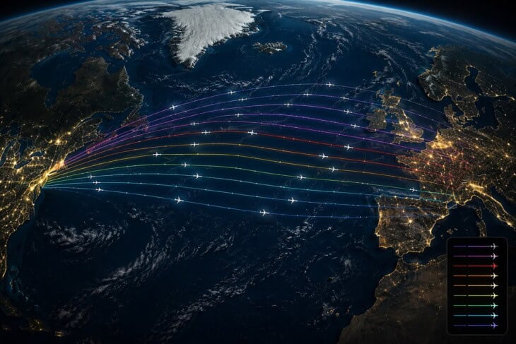
The next time you are on a transatlantic flight and you notice the moving map showing nothing but ocean for the next four hours, your aircraft is one of several dozen on a precisely planned track, its position updated every eight seconds to a satellite overhead, its Mach number chosen to maintain constant spacing with the aircraft ahead. The controllers in Gander and Prestwick have more situational awareness than they have ever had. The ocean is real. The radar gap is real. And the system that fills it has been evolving continuously since the first jet-age crossings, and is still getting sharper.
For the full picture of how an IFR clearance is built before a flight even reaches the oceanic entry point, the article on flight routes and clearances covers the airways and clearance structure that frames every flight in domestic airspace. The knock-on effect of oceanic flow on the ground, when departure slots are managed to maintain spacing on the tracks, connects directly to how ground stops and flow control work. Both are part of the How Air Traffic Control Actually Works series.
FAQ
Sources and references used for research and fact-checking.
- North Atlantic Tracks - Wikipedia
- NAT-HLA Explained: The North Atlantic Airspace - Wade Aviation
- North Atlantic Operations — Organised Track System - SKYbrary
- North Atlantic Operations — Airspace - SKYbrary
- North Atlantic Operations — ATC Clearance - SKYbrary
- North Atlantic Operations — Communications - SKYbrary
- How SELCAL Works - Aviation Spectrum Resources Inc. (ASRI)
- Six Years of Space-Based ADS-B: Transforming North Atlantic Airspace - NATS
- Space-Based ADS-B Surveillance Improves Trips Over the North Atlantic - NAV CANADA
- Section 7. North Atlantic ICAO Region - FAA Air Traffic Control Handbook (JO 7110.65)
- North Atlantic Tracks - ForeFlight
Get the Newsletter
The latest aviation news and stories sent to your inbox.
About the Author

Tim is the owner and lead editor of AeroCorner since 2019, overseeing aviation content covering aircraft, airlines, airports, and the broader aviation industry. Through years of researching, writing, editing, and publishing aviation-focused content, he has developed extensive practical knowledge of commercial aviation and air travel. Based in Asia and a frequent traveler himself, Tim also brings firsthand passenger experience to AeroCorner’s coverage. Outside of publishing, he has also explored aviation firsthand through hands-on flight training in New Zealand.