

Table of Contents
On September 3, 2007, at about 9:30 a.m., Steve Fossett’s borrowed Super Decathlon struck a ridge in California’s Sierra Nevada, about 8 miles (13 km) west-northwest of Mammoth Lakes. He was 63 and alone in the airplane, and he did not survive. The wreckage was not found for 13 months.
The popular version is that he vanished into the Nevada desert so completely that some people decided he had faked his death. The record says otherwise.
He crashed in California, 65 miles (105 km) south of where he took off, and a radar track ending about 1 mile (1.6 km) from the crash site was in front of the searchers. They ruled it out because a witness had the time of a sighting wrong by an hour.
This article is built from the National Transportation Safety Board’s final report on accident SEA07FA277, published on July 9, 2009. Every time, altitude and finding below comes from that report unless another source is named.
About 8:15 a.m.
Preflight at the Flying M Ranch. The ranch’s chief pilot has the Super Decathlon out of its hangar with full fuel. Fossett tells him he is heading south to Highway 395.
8:20 to 8:30 a.m.
Takeoff. He departs the private strip near Yerington, Nevada, elevation 4,953 feet. No flight plan is filed for the personal flight.
8:25 to 8:35 a.m.
The sighting that misled the search. A ranch employee sees the airplane flying south at 150 to 200 feet, about 9 miles from the strip. The time is later reported an hour late.
9:07 a.m.
A radar track begins. A target about 35 miles south-southwest of the ranch heads south along the crest of the Sierra Nevada, its transponder at first reporting 14,500 to 14,900 feet.
9:27 a.m.
The track ends. The last return is about 1 mile northwest of where the wreckage will be found.
About 9:30 a.m.
The crash. Heading north after a turn of about 180 degrees, the airplane strikes terrain at about 10,000 feet, some 300 feet below the crest of a ridge.
About 11:30 a.m.
Overdue. Expected back by 10:30 or 11:00, he has not returned. An aerial search starts within 30 minutes. No radio call and no emergency beacon signal are ever received.
Oct. 2, 2007
Search suspended. The Civil Air Patrol ends its search after about a month.
Oct. 1, 2008
Found. A hiker near Minaret Summit turns in Fossett’s pilot certificate and another ID card. An air search finds the wreckage about half a mile away.
July 9, 2009
Final report. The NTSB publishes its probable cause: downdrafts that exceeded the airplane’s ability to climb.
What happened
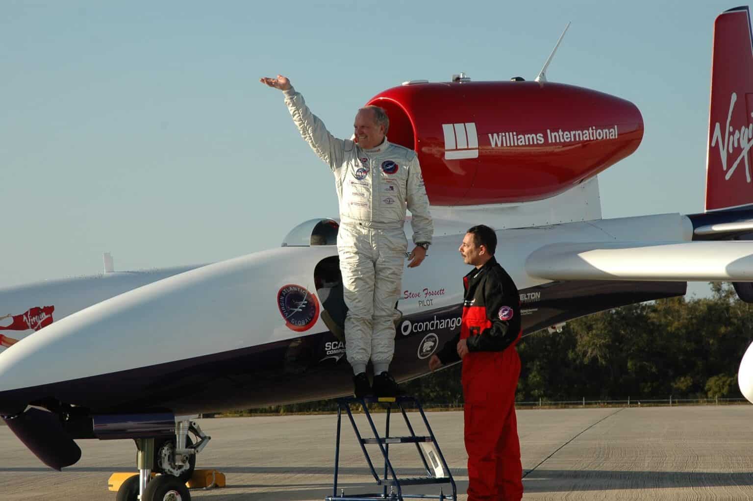
Fossett was among the most accomplished pilots alive. He made the first solo nonstop balloon flight around the world in 2002, and in 2005 flew the Virgin Atlantic GlobalFlyer solo around the world nonstop without refueling, in 67 hours.
The NTSB lists an airline transport pilot certificate, commercial privileges in seaplanes and helicopters, glider and balloon ratings, and type ratings in four business jets. He had renewed his training in the Cessna Citation X that April, and reported 6,731 flight hours on his last medical application.
The airplane that morning was much simpler. N240R was a two-seat, tailwheel Super Decathlon built by Bellanca in 1980, with a 180-horsepower Lycoming engine and no GPS receiver. It belonged to the Flying M Hunting Club, on hotelier Barron Hilton’s ranch, and the club’s chief pilot estimated Fossett had about 40 hours in it.
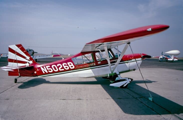

Early coverage said he was scouting for a land speed record attempt. His wife told investigators the flight was for pleasure, “a Sunday drive.” He was not wearing the parachute required for aerobatics and gave no sign he planned any.
He told the chief pilot he was going south toward Highway 395, which runs along the eastern side of the Sierra Nevada. The radar track found later shows him flying south along the crest of the range, about 10 miles (16 km) west of that highway, at first above 14,500 feet (4,420 m).
The track ended at 9:27 a.m. The wreckage told the rest: the airplane hit the slope on a northerly heading, right wing low and nearly level, at high speed. Fossett had turned around after radar lost him, and the engine was running at impact.
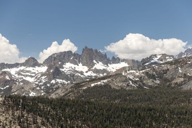
The crash site sits within the Ansel Adams Wilderness, among peaks above 13,000 feet (3,960 m). The impact destroyed the emergency locator transmitter, so it never sent a signal.
What the NTSB found
The NTSB’s probable cause was “the pilot’s inadvertent encounter with downdrafts that exceeded the climb capability of the airplane.” Contributing were “the downdrafts, high density altitude, and mountainous terrain.”
There was no mechanical cause. Investigators found nothing in the airframe or engine that would have prevented normal operation, and the propeller damage showed the engine was producing power when the airplane hit.
The weather was clear. Mean winds at 10,000 feet (3,050 m) were from the southwest at 15 to 20 knots, with possible gusts of 25 to 30 knots. The Board found that moderate turbulence and downdrafts of at least 400 feet per minute probably occurred at the crash site at that time.
That figure came from a weather simulation run by a meteorologist. On an 800-meter grid the model showed downdrafts of about 300 feet per minute, which he said probably understated them, and a finer 600-meter run showed close to 400.
The airplane’s own manual sets the other side of the comparison. At full throttle and maximum weight, its best climb was 370 feet per minute at 12,000 feet and 300 feet per minute at 13,000 feet.
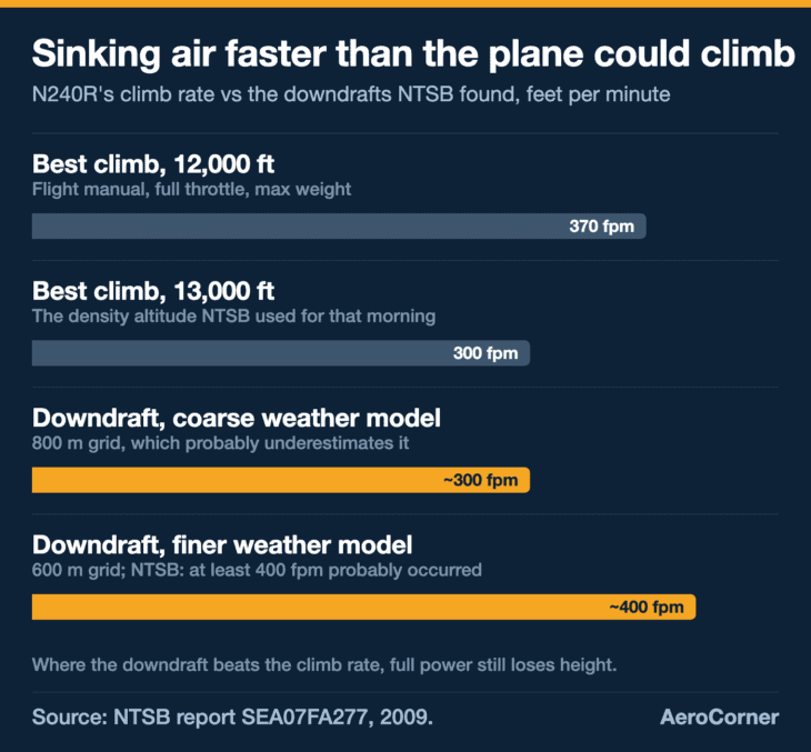
Put those together and the finding is simple arithmetic. With the air sinking faster than the airplane could climb, full power still lost height, and the ridge was about 300 feet (90 m) above the point of impact.
The report does not say why Fossett was that low near the ridge, or what he intended in his last minutes. Toxicology was not performed, and the NTSB made no finding about his health or state of mind.
What most accounts get wrong
Fossett did not vanish into the Nevada desert, and there is no mystery about where he went. He crashed in California’s Sierra Nevada, 65 miles south of the ranch. A radar track ending about a mile from the crash site was found during the search, then ruled out because a ranch employee’s sighting was logged at 9:25 to 9:35 a.m. Phone company records later showed it was 8:25 to 8:35. The crash area had been searched once from the air, and aircraft had flown over the wreck without seeing it.
Why a 180-horsepower airplane could not climb out
The key idea is density altitude: the altitude the airplane “feels,” based on how thin the air actually is. Warm air is thinner, so on a hot day an airplane at 10,000 feet performs as if it were much higher. If pressure altitude is the number on the altimeter, density altitude is the number the wings and engine respond to.
That morning the NTSB estimated 18°C (64°F) at 10,000 feet, about 23°C warmer than the standard atmosphere. That put the density altitude at the crash site near 12,700 feet (3,870 m).
The FAA’s mountain flying pamphlet notes that a normally aspirated engine loses about 3% of its power per thousand feet of density altitude. The engine maker’s table in the report puts N240R’s engine at 63.4% of its 180 horsepower at 13,000 feet, about 114 horsepower.
Wind is the other half. Air blowing across mountains rises on one side and sinks on the other, and the FAA describes very strong up and down drafts that form downwind of ridges. Downdrafts are invisible in clear air, which is why turbulence in the mountains so often catches pilots out.
Other pilots flying near the area that day show how patchy it was. One crossed near Mount Ritter at 13,500 feet and called it “a wonderful day to go flying.” Another, in a King Air, described smooth air interrupted by “random rough chop” and called it “a weird day.”

Glider pilots like Fossett use the same air the other way, riding the rising side of a ridge to stay aloft without an engine.
The FAA’s guidance for powered airplanes is to cross a ridge at least 1,000 feet above it, or 2,000 feet when mountaintop winds exceed 20 knots, at a 45-degree angle so there is room to turn away from a downdraft.
Why the search took 13 months
The search covered about 20,000 square miles (51,800 km²) of mountains and desert. It was described at the time as the largest in US history for a missing plane, and the Las Vegas Sun reported that Nevada’s 17-day effort cost the state $1.6 million.
It also went online. Amazon put fresh DigitalGlobe satellite imagery on its Mechanical Turk platform, so anyone with a computer could scan the search area for wreckage. It did not find the airplane.
Little pointed to where he had gone. The airplane carried no GPS, no flight plan was filed, and the beacon was destroyed on impact.
Then there was the witness. Because the ranch employee’s sighting was logged at 9:25 to 9:35 a.m., a radar target over the Sierra crest at 9:07 to 9:27 could not be Fossett.
Only after the wreck was found did a review of the phone company’s log show the sighting was an hour earlier, and the discarded track became the flight’s last known path.
An Illinois judge declared Fossett legally dead on February 15, 2008. That summer, a British tabloid floated the idea that he had faked his death, a theory his wife and his friend Richard Branson dismissed.
The hiker’s find in late September 2008 ended the question. The wreckage was about half a mile from the ID cards, and DNA testing by a California Department of Justice lab confirmed remains found nearby as Fossett’s. The cause of death was multiple traumatic injuries.
What changed
No regulation. The final report contains no safety recommendations, and the hazards it names, density altitude and mountain downdrafts, were already covered in FAA guidance written for exactly this kind of flight.
What the case left behind is a lesson about searching. The answer was in the radar data from the first days. A single witness time, recalled from a phone call and never checked against a record, was enough to rule it out, and the search spent a month looking everywhere else.
It is also a lesson about experience. Fossett held ratings in airplanes, helicopters, gliders and balloons, and the report shows how little that counts against air sinking faster than a light airplane can climb.
FAQ
Sources and references used for research and fact-checking.
- National Transportation Safety Board, Aviation Investigation Final Report SEA07FA277: Bellanca 8KCAB-180, N240R, Mammoth Lakes, California, September 3, 2007
- National Transportation Safety Board, Investigation docket SEA07FA277
- Federal Aviation Administration, Tips on Mountain Flying (FAA-P-8740-60)
- Las Vegas Sun, Has Fossett flown the coop?
- AVweb, You Might Help Find Steve Fossett
- Wikipedia, Steve Fossett
Get the Newsletter
The latest aviation news and stories sent to your inbox.
About the Author
Tim is the owner and lead editor of AeroCorner since 2019, overseeing aviation content covering aircraft, airlines, airports, and the broader aviation industry. Through years of researching, writing, editing, and publishing aviation-focused content, he has developed extensive practical knowledge of commercial aviation and air travel. Based in Asia and a frequent traveler himself, Tim also brings firsthand passenger experience to AeroCorner’s coverage. Outside of publishing, he has also explored aviation firsthand through hands-on flight training in New Zealand.