Some terms in aviation stick around awhile. In some circumstances, the term outlives the technology! DME is the perfect example of something that made sense a few decades ago but is quickly becoming oddly outdated.
DME stands for distance measuring equipment. At one point, this was a stand-alone radio that read out your distance to a VOR station. Nowadays, the term “DME” is used to refer to any piece of equipment that can give you your precise distance from a station, such as GPS.
It’s also used to describe the distance from a station. For example, a controller may tell a pilot to make a position report or start a hold at “10 DME.”
Why Was DME a Big Deal?
In the days before big screen multifunction displays and technically advanced aircraft (TAA), DME was pretty darn handy. Most aircraft were equipped with one or two VOR receivers. But these receivers could only tell you your bearing from the VOR. To figure out your position, or your distance from that VOR, you’d have to use a cross radial from a different VOR.
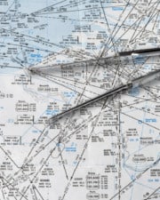
This required using the second NAV receiver in the plane, or worse yet, reprogramming the first one while staying on course. You could then use your paper chart to figure out your position and manually measure how far away from the VOR ground station you were.
Distance measuring equipment changed all of that. With a small piece of avionics, the pilot could now know their distance from the station. And since pilots fly directly to or directly away from VORs most of the time, the DME had the added benefit of calculating the time to station and ground speed for the pilot.
How Does DME Work?
Different brands of avionics function slightly differently, but generally, a DME is programmed to the VOR frequency that the pilot wants the distance from. Like other navigation radios, the station can be positively identified by an audible morse code identifier, but DME identifiers only sound every 30 seconds.
Some planes with more advanced systems simply pair a small display that is connected to the NAV1 radio. It may show the distance on an independent display or the horizontal situation indicator (HSI), if so equipped.
DME is a fundamentally simple technology that uses a radio signal to transmit to the VOR ground station. A transponder at the VOR station replies. The DME unit onboard the aircraft measures how long it takes to receive a reply from the station. It can then calculate the distance of a straight line between the two points.
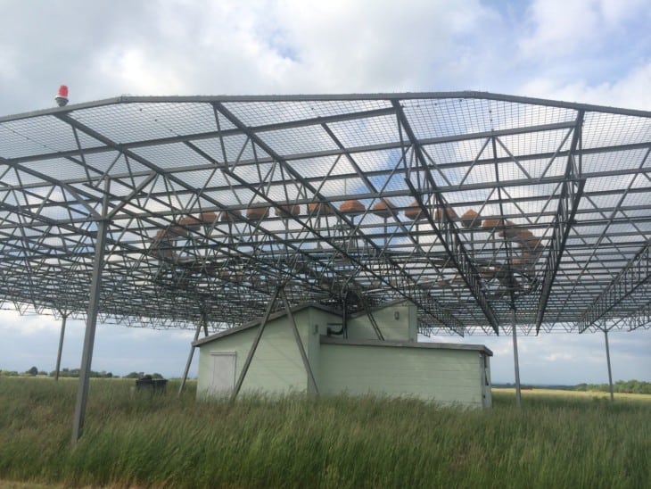
DME does not work with every VOR. The VOR has to have the right equipment. Types of VOR that have DME include VOR-DME and VORTAC stations. Some localizers also use DME for instrument approaches.
Problems with DME
Sharp readers may have already picked up that DME distances are straight line measurements. Since the airplane is in the air and the VOR is on the ground, it’s actually a slanted line. The length of that line is going to be longer than a line drawn on a chart, which would be the true distance.
Therefore, DME has a built-in error because it measures the slant range distance. When the aircraft is very high or near the station, the error is more pronounced. For example, if an aircraft were 6,000 feet MSL directly over a DME station, it would indicate 1.0NM DME from the station, even though the plane is directly over the station.
While this may sound like a big problem, in truth, it is usually only noticeable when you are very near the VOR. The pilot’s rule of thumb is that if you are at least 1 nm away for every 1,000 feet AGL, then the error is not going to be a problem.
That means that for an aircraft cruising at 10,000 feet, their DME is going to be accurate anytime they are more than 10 nm away from the VOR. As they descend, they will get a more precise DME distance even closer. Not that bad, really.
DME Range
DME radio operates over line-of-sight distances, just like VHF communications and navigation radios. The limiting factor is the transmission power of the airplane’s DME unit.

The Aeronautical Information Manual states that DME signals may be received up to 199 miles from the station, but that is rare and true at only very high altitudes. Realistically, for small aircraft, the DME’s range is about 50 miles. If mountainous terrain blocks the signal, it might be even less.
For more on the specifics of DME, check out section 1-1-7 of the Aeronautical Information Manual.
How We Get DME Distances Today
As technology became more advanced, avionics manufacturers began creating area navigation, or RNAV, systems. These systems allowed a pilot to program any point that they liked, as long as it referenced a VOR radial and DME distance, and then navigate directly there. For the first time, pilots could navigate directly to anywhere they wanted, not just to an installed ground navigation aid.
RNAV became common in larger aircraft. RNAV routes enabled pilots to operate off of established airways and navigate directly to their destination.
Today, area navigation is still around, but it’s used to describe the capability of GPS units. Like their analog counterparts of yesteryear, GPS allows pilots to navigate directly from point to point, not limited by the location of VOR stations along the way.
GPS has become much more common than RNAV systems ever did. A properly installed and certified GPS unit can legally replace a DME unit, so an aircraft with GPS may use DME fixes and approaches as published.
Read more about how GPS has replaced legacy DME equipment for most operators, and how the system worked in AOPA’s Flight Training Magazine.
When is DME Required
DME, or a legal GPS/RNAV system that replaces it is required above FL240.
DME is also required to fly many instrument approach procedures. If DME is required, the approach chart title will include it, for example, VOR/DME RWY 9. For approaches like this, there are no VOR cross radials or other navigation stations along the route to identify the course fixes.
Related Posts

