

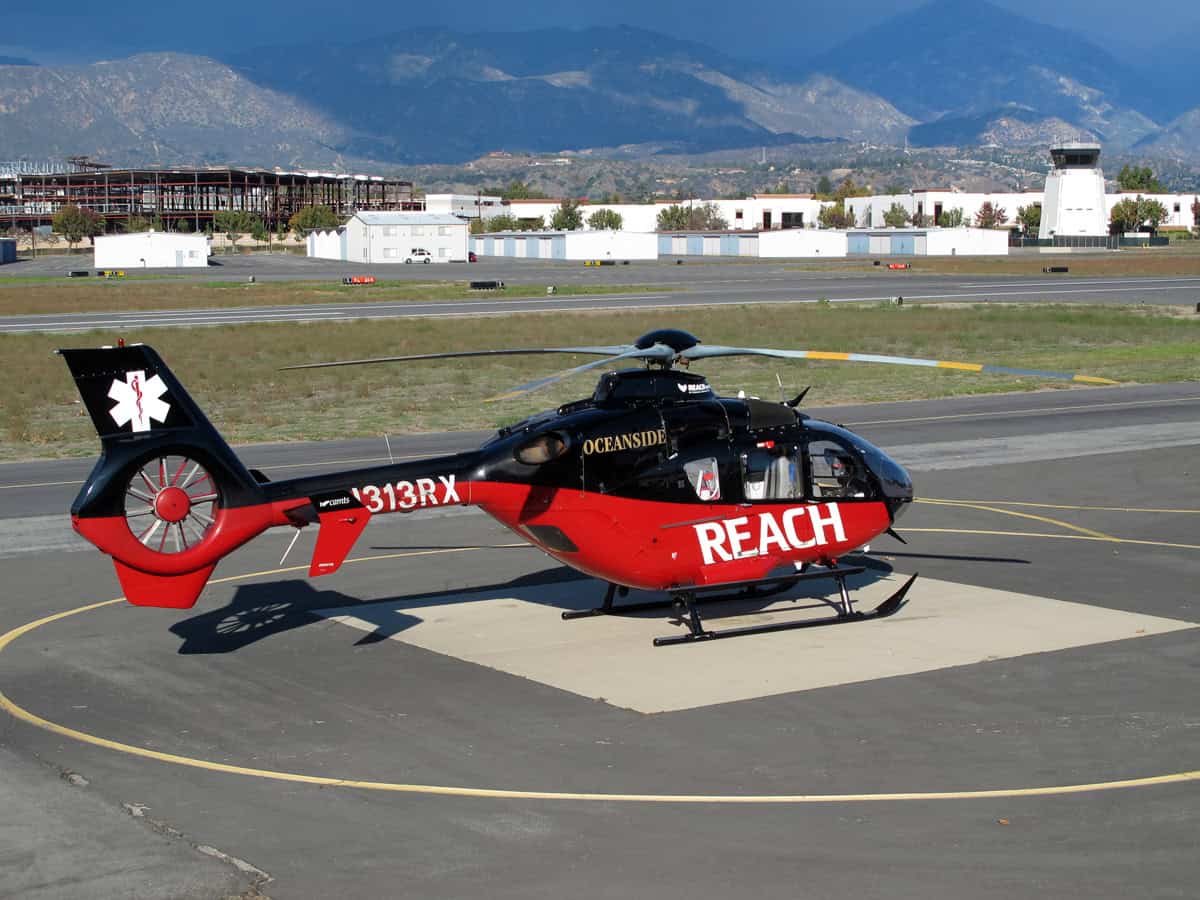
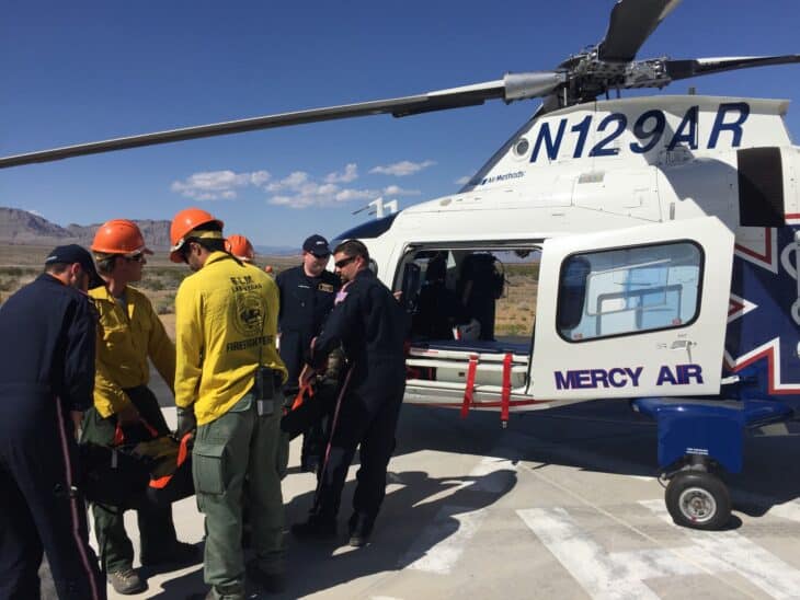
About a minute before REACH Air Medical Services helicopter N313RX crashed into the Pacific off Catalina Island on September 30, 2026, a second air ambulance leaving the same helipad dropped low enough to touch the water. The FAA has confirmed it is looking into that earlier incident, involving a Mercy Air helicopter operated by Air Methods.
The Mercy Air crew recovered and flew on to the mainland. The REACH Eurocopter EC135 did not: three of the five people aboard died, as AeroCorner reported in our first story on the crash.
What the Mercy Air pilot reported
The account became public when CBS Los Angeles reported on the night of October 13 that it had seen an internal Air Methods report, shared by a paramedic. The Los Angeles Times followed on October 14 with redacted records obtained by TheDoctorMedic.com and its own reading of public flight-tracking data.
According to those reports, the Mercy Air helicopter lifted off from the Pebbly Beach helipad near Avalon at about 7:45 p.m., bound for Harbor-UCLA Medical Center. Roughly 40 seconds into the flight, tracking data show it falling to about 75 feet.
In the internal report, which the Times says was written on October 7, the pilot described flying on night-vision goggles with no moon over a calm ocean. He wrote that he noticed the helicopter had descended from 150 feet to 75 feet, made control corrections, and then “felt a thump and spray under chin bubble,” which he called obvious contact with the water.
A witness told CBS LA the helicopter’s belly touched the water, pulled up, and touched it a second time before the pilot regained control. The aircraft then completed the roughly 20-minute flight to the hospital, and CBS LA’s sources say it was grounded soon after landing.
.jpg)
The Mercy Air helicopter’s registration has not appeared in the coverage so far, and AeroCorner could not confirm it. The Times describes it as a Eurocopter; the exact model is not confirmed.
Air Methods had not answered CBS LA’s emails about the incident as of October 13.
Where N313RX went down
Online flight-track data cited by the Times show the REACH EC135 climbing to about 175 feet at 7:46 p.m. after leaving the same Pebbly Beach pad, then descending rapidly seconds later. CBS LA reports that the flight data put the crash in nearly the same spot where the Mercy Air helicopter had touched the water.
The pilot, Steve Robinson, and flight nurse Jessica deVries were killed, along with the patient they were flying to the mainland. Two others aboard were rescued from the water.
Los Angeles County Sheriff’s divers recovered the patient’s body from the wreckage, about 218 feet down, a day later, as covered in our story identifying the victims.
Two agencies, two separate events
“The FAA is aware of and looking into an incident involving a medical helicopter that departed from Catalina Island shortly before a different helicopter that crashed,” the agency said in a statement to the Times. The FAA did not answer the paper’s question about why the Mercy Air event is missing from its public list of accidents and incidents, which lists only the EC135 crash at Avalon that night.
The NTSB leads the investigation into the fatal crash. Its spokesperson Peter Knudsen told the Times: “We are definitely aware of this information about the other helicopter.”
His reported comment did not say whether the board will examine the Mercy Air event.
AeroCorner found no NTSB preliminary report on N313RX on the board’s website when it checked on October 15. The probable cause will come later: the NTSB says it tries to complete an investigation within 12 to 24 months.
What this does and does not show
Two helicopters leaving the same pad a minute apart, in the same darkness, both lost height over the same stretch of water. That is a striking coincidence, not a finding. In their statements so far, neither agency has linked the two events, no cause has been determined for the REACH crash, and the Mercy Air details come from an internal report, witnesses and flight tracking, not from the FAA or NTSB.
Why a dark-night departure over water is hard
The FAA’s pilot guidance says the illusions behind spatial disorientation are most likely when outside visual references are unreliable or missing, as the Mercy Air pilot described. It also notes that a night takeoff from a well-lit airport into a totally dark sky, a so-called black hole, can trigger an illusion that the nose is pitching up, and the natural correction is to push it down.
The same FAA brochure attributes 5 to 10% of general aviation accidents to spatial disorientation and says 90% of those are fatal.
Night-vision goggles help less than they might seem to over open water. Retired pilot and flight instructor Augustine Joseph told CBS LA there is “very little depth perception” with goggles in minimal light, and that with water and an obscured horizon judging height is “extremely, extremely difficult.”
Federal rules require helicopter air ambulances to carry a helicopter terrain awareness and warning system, which gives the crew audio and visual warnings. None of the reporting so far says whether either crew got a warning that night.
Sources and references used for research and fact-checking.
Get the Newsletter
The latest aviation news and stories sent to your inbox.
About the Author
Tim is the owner and lead editor of AeroCorner since 2019, overseeing aviation content covering aircraft, airlines, airports, and the broader aviation industry. Through years of researching, writing, editing, and publishing aviation-focused content, he has developed extensive practical knowledge of commercial aviation and air travel. Based in Asia and a frequent traveler himself, Tim also brings firsthand passenger experience to AeroCorner’s coverage. Outside of publishing, he has also explored aviation firsthand through hands-on flight training in New Zealand.