

Table of Contents
There is a moment on every cross-country flight when a pilot has been heads-down in the cockpit — managing the radio, checking fuel, working through the cruise checklist — and finally looks up to find they are not quite sure where they are. They know their heading: the heading indicator has been showing 075° the whole time. But they have not checked whether 075° is what they actually set before departure, or what the instrument has slowly drifted to since. After twenty minutes in the air without a check, those two numbers can diverge by enough to put the aircraft several miles off its intended track.
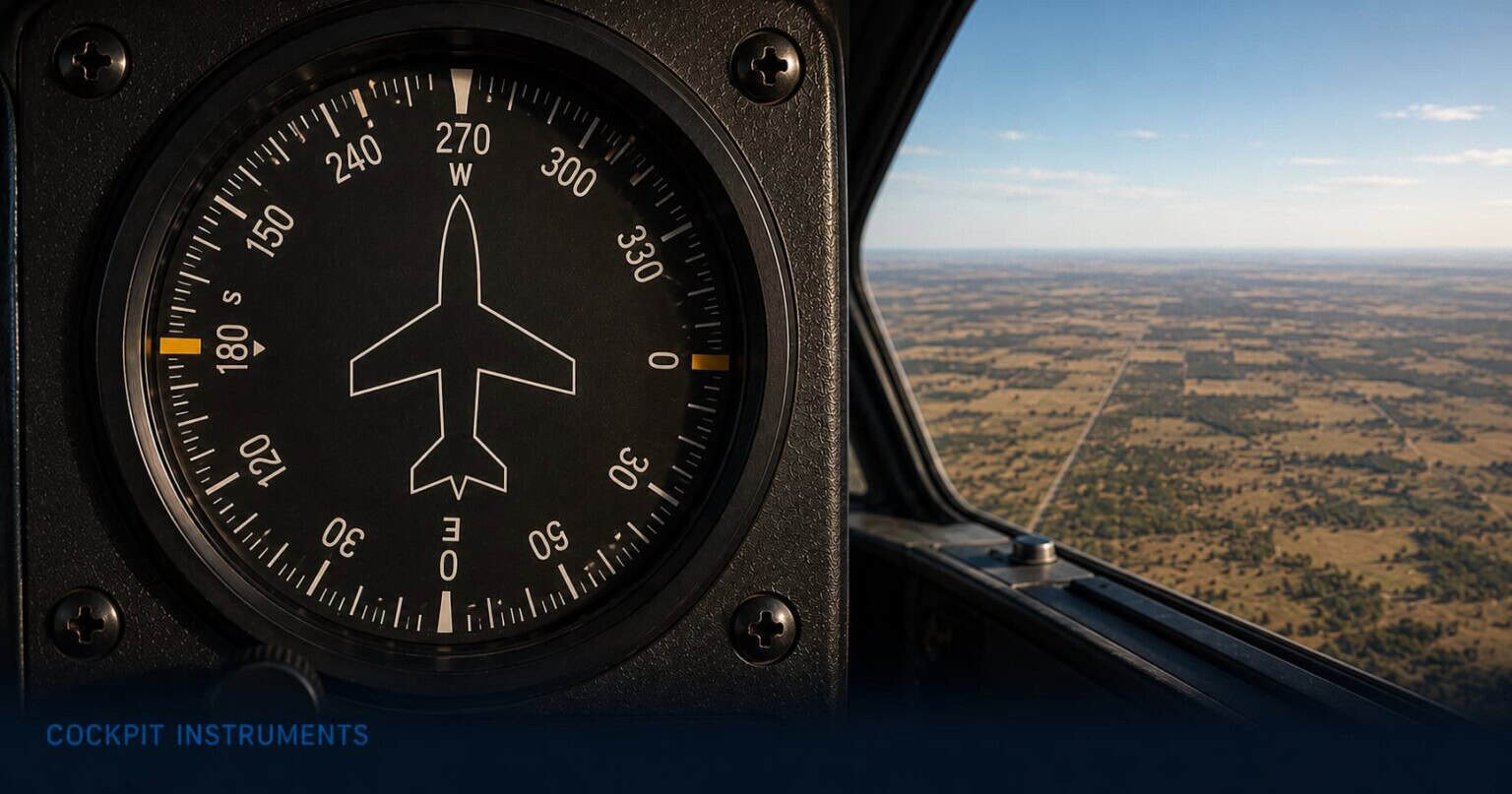
The heading indicator shows the direction the aircraft’s nose is pointing, expressed in degrees. Zero is north, 90 is east, 180 is south, 270 is west. It is the instrument pilots use to hold a course, execute ATC clearances to turn to a specific heading, and navigate from one point to another. A magnetic compass does the same job in principle, but in practice a magnetic compass is erratic in flight — it swings and lags during turns, lurches during acceleration, and cannot be read accurately when the aircraft is anything other than perfectly straight and level. The heading indicator uses a gyroscope to give a stable, smooth reading that can be trusted during the turns and manoeuvres of a normal flight.
The catch is that the gyroscope drifts. Left uncorrected, the heading indicator will slowly wander away from the true magnetic heading, and a pilot who is not checking will not notice until they are somewhere they did not plan to be. This article explains what the heading indicator shows, how pilots use and verify it throughout a flight, and why the compass that pilots distrust for precision flying is also the only thing that keeps the heading indicator honest.
What the heading indicator shows
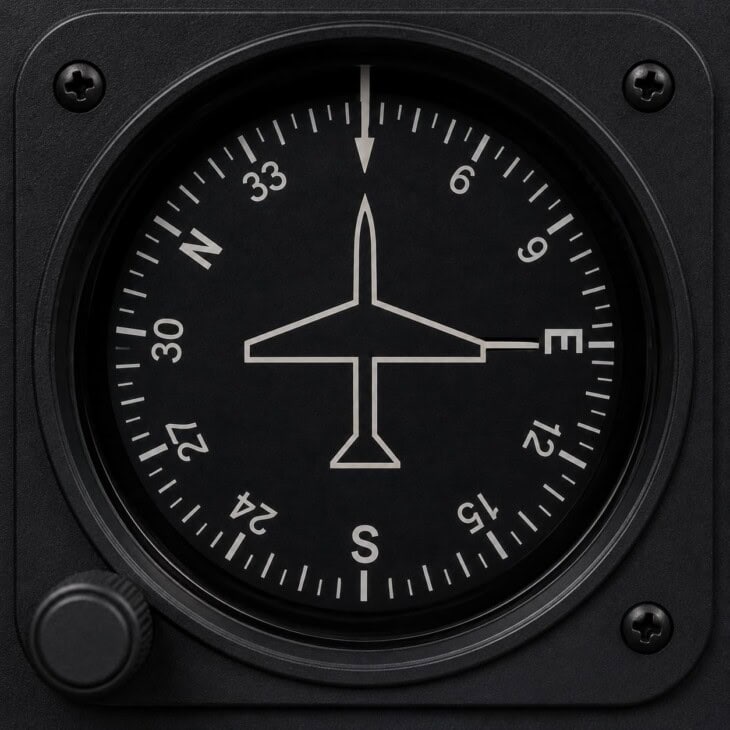
The face of the heading indicator is a rotating compass card — a circular disc marked with degree numbers — viewed through a fixed reference mark at the top of the instrument called the lubber line. As the aircraft turns left, the card rotates right; as the aircraft turns right, the card rotates left. Whichever degree number lines up with the lubber line is the aircraft’s current heading. North appears at the top when the aircraft is pointing north; east, south, and west rotate into position as the aircraft turns to face them.
The degree numbers on the card are abbreviated: 36 for 360° (north), 27 for 270° (west), 18 for 180° (south), 9 for 90° (east). Index marks every 10 degrees fill in the scale between the major points, giving the pilot heading resolution down to the nearest five degrees or so at a glance. A small knob on the instrument allows the pilot to rotate the compass card manually to align it with the magnetic compass reading. Once aligned, the gyroscope inside the instrument holds the card steady during manoeuvres that would send the magnetic compass swinging wildly.
In older aircraft the instrument is often called the directional gyro (DG) or direction indicator (DI) — different names for the same thing. In more modern analogue installations it may be combined with navigation information to form a horizontal situation indicator (HSI). In glass cockpit aircraft, the HSI takes over the entire heading function with a far richer display. All of these versions share the same underlying job: giving the pilot a stable, readable heading reference during flight.
How pilots read the heading indicator in flight
The heading indicator must be set before every flight. As part of the pre-takeoff checks, with the aircraft stationary, the pilot reads the magnetic compass — which is reliable when the aircraft is not accelerating or turning — and rotates the heading indicator’s knob until the compass card shows the same number under the lubber line. Many pilots also cross-check against the runway: if they are lined up on Runway 09, the heading indicator should show approximately 090°. A significant discrepancy at this point is worth pausing to investigate before departure.
During taxi, the pilot watches the heading indicator to confirm it moves in the correct direction through turns. A heading indicator that does not respond, or that responds too slowly, may not yet have fully erected — the gyro needs a few minutes to spin up to operating speed after engine start. Once airborne, the instrument becomes one of the most frequently referenced in the panel. ATC clearances are issued in magnetic headings: “turn left heading 360”, “fly runway heading 230”. The pilot turns to the instructed heading using the heading indicator as the reference, because the magnetic compass cannot give a reliable reading while the aircraft is banked in a turn.
Holding a specific heading in cruise requires regular small corrections. Wind pushes the aircraft sideways, causing it to drift off heading even when the nose appears to be pointed the right way. The heading indicator shows this drift immediately: the lubber line creeps away from the target number, and the pilot applies a small bank to bring it back. This continuous heading management is one of the things that separates visual flying — where a pilot can look at a landmark and point toward it — from instrument flying, where the heading indicator is the only reference for direction.
Every fifteen minutes or so, the pilot checks the heading indicator against the magnetic compass and corrects any drift. This is done in straight and level flight, when the compass is most reliable. The pilot reads the compass, notes whether the heading indicator agrees, and adjusts the knob if needed. In a busy phase of flight this check can be delayed, but letting it go too long means the heading being flown may no longer be the heading displayed.
Why the magnetic compass cannot replace the heading indicator
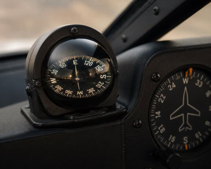
In the Northern Hemisphere, the magnetic compass undershoots northerly headings and overshoots southerly ones during turns — a dip-related effect pilots remember as UNOS (Undershoot North, Overshoot South). It also swings north during acceleration and south during deceleration (ANDS: Accelerate North, Decelerate South). After any manoeuvre, it oscillates before settling. The heading indicator’s gyroscope is unaffected by all of these forces, which is why the compass is used only as a reference to calibrate the HI — not as the primary heading instrument during flight.
What pilots watch out for
The heading indicator’s defining limitation is gyroscopic precession. The spinning gyro is subject to slow mechanical forces — bearing friction, tiny imbalances, and the rotation of the Earth beneath the aircraft — that cause its axis to drift over time. Most general aviation heading indicators drift between three and eight degrees per hour under normal conditions. Eight degrees per hour sounds small, but over a thirty-minute flight without a realignment check it produces four degrees of heading error. At a cruising speed of 120 knots, four degrees of heading error translates to a track deviation of about eight nautical miles per hour. A pilot who forgets to realign for forty-five minutes can find themselves flying a heading that looks correct on the instrument but is taking them meaningfully off course.
The error compounds invisibly. There is no flag on the instrument, no warning light, no indication that the heading displayed is no longer the heading being flown. In clear weather over recognisable terrain, the drift will become obvious when landmarks stop matching the expected position. In cloud, at night, or over featureless terrain, the pilot may continue to trust a slowly wrong instrument until the navigation becomes undeniably broken.
Flying the wrong heading: Korean Air Lines Flight 007
On 1 September 1983, Korean Air Lines Flight 007, a Boeing 747 en route from Anchorage to Seoul, was shot down over the Sea of Japan after flying deep into Soviet restricted airspace. ICAO investigators determined that the aircraft’s autopilot had been left in heading hold mode rather than inertial navigation mode after departure from Anchorage. Instead of following its programmed route, the aircraft held a fixed magnetic heading — gradually drifting hundreds of nautical miles off track. The crew made no navigation cross-checks that would have revealed the deviation. All 269 people on board were killed. The accident is the most dramatic example in aviation history of the consequences of flying a fixed heading without verifying the actual track against the planned route.
The other significant failure mode for the heading indicator is loss of vacuum. Like the attitude indicator, the analogue heading indicator in many general aviation aircraft is powered by the engine-driven vacuum pump. A pump failure takes both instruments offline simultaneously, removing the pilot’s heading and attitude reference in a single event. In visual conditions, the pilot can navigate by looking outside. In cloud or darkness, the magnetic compass becomes the backup heading reference — but using it requires timed turns, patience, and a disciplined instrument scan that most pilots have only practised occasionally. The backup procedure works, but it is significantly harder than flying with the heading indicator, and workload spikes sharply at exactly the moment the pilot needs to concentrate on other things.
The heading indicator in a glass cockpit
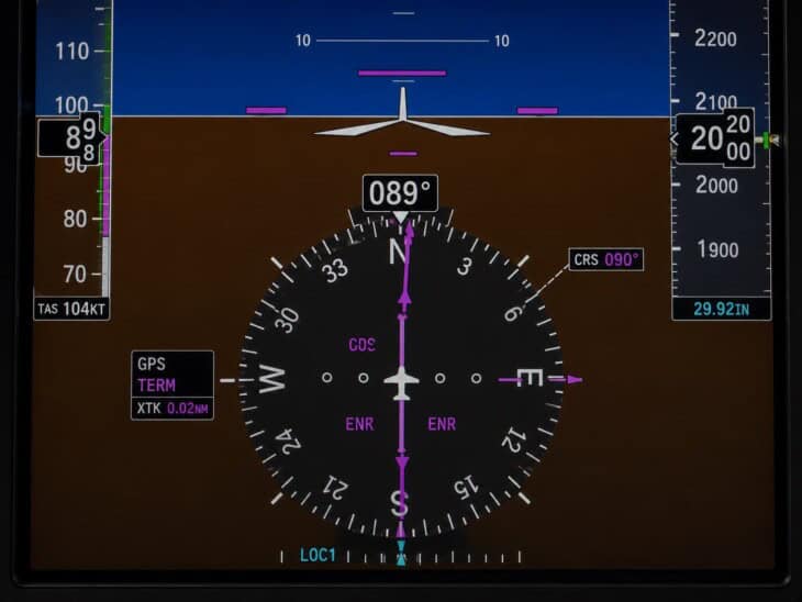
In glass cockpit aircraft, the heading indicator is replaced by a horizontal situation indicator — an HSI — displayed on the Primary Flight Display. The heading appears as a rotating compass rose around the perimeter of a circular display, with a lubber line at the top and a large digital readout of the current heading above it. A moveable course pointer on the compass rose shows the pilot’s selected navigation course, and a deviation bar shows how far the aircraft has drifted from that course. The result is a single instrument that shows the pilot their heading, their intended track, and their displacement from it simultaneously — information that requires cross-referencing three separate analogue instruments to assemble in a conventional cockpit.
More significantly, the glass cockpit HSI eliminates precession drift entirely. The heading data comes from a solid-state magnetometer continuously cross-corrected against GPS track information. There is no gyro to precess, no fifteen-minute realignment check, and no accumulated error. The heading shown is accurate and current at all times without any pilot input. The compass and its errors do not disappear — the magnetometer still senses magnetic north, and magnetic variation between magnetic and true north still applies — but the instrument’s self-correction means the pilot is always looking at the right number without having to manage it.
The heading indicator sits at the bottom centre of the basic T in the six-pack, directly below the attitude indicator. The two are closely related: both are gyroscopic instruments, both are typically powered by the vacuum system in analogue aircraft, and a vacuum failure takes both out together. The turn coordinator provides a partial backup for heading control when both fail — it cannot show a heading, but it can confirm the aircraft is turning and at what rate. For the full picture of how all cockpit instruments work together, see Airplane Cockpit Instruments Explained.
FAQ
Get the Newsletter
The latest aviation news and stories sent to your inbox.
About the Author

Tim is the owner and lead editor of AeroCorner since 2019, overseeing aviation content covering aircraft, airlines, airports, and the broader aviation industry. Through years of researching, writing, editing, and publishing aviation-focused content, he has developed extensive practical knowledge of commercial aviation and air travel. Based in Asia and a frequent traveler himself, Tim also brings firsthand passenger experience to AeroCorner’s coverage. Outside of publishing, he has also explored aviation firsthand through hands-on flight training in New Zealand.