

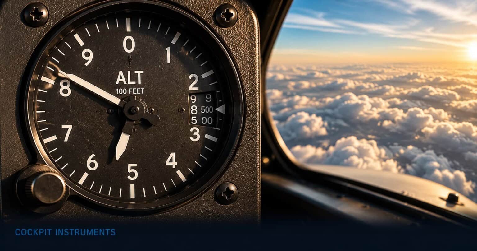
Table of Contents
There is a moment in every flight, usually during the descent, when a pilot reaches down to a small knob on the instrument panel and gives it a deliberate twist. To a passenger watching, it looks like a minor adjustment, barely worth noticing. What the pilot is actually doing is calibrating the altimeter to local atmospheric conditions, a step that can mean the difference between the aircraft being exactly where the pilot thinks it is and being hundreds of feet lower. The altimeter is deceptively simple to look at. Understanding what it actually measures, and what can go wrong when a pilot uses it incorrectly, reveals why that small knob matters so much.
The altimeter shows how high the aircraft is above sea level, displayed in feet. It is one of the three instruments at the top of the basic T in the six-pack, sitting to the right of the attitude indicator. In clear conditions, altitude seems easy to judge from the outside, but at night, in cloud, or over featureless terrain, a pilot has no visual reference at all. The altimeter is the only way to know whether the aircraft is at 4,000 feet or 3,000 feet, which in hilly terrain can be the difference between safe clearance and a hillside.
This article explains what the altimeter shows, how a pilot reads and sets it during a real flight, and why incorrect altimeter settings are among the most persistent causes of serious accidents in aviation.
What the altimeter shows
The face of an altimeter looks similar to a clock, with a circular scale running from zero to around 1,000 marked around the edge. Two needles move across that scale simultaneously. The longer needle is the primary pointer and makes one full revolution every 1,000 feet: when it points straight up, the aircraft is at some multiple of 1,000 feet, and when it points to the 5, the aircraft is at some 500-foot mark. A shorter secondary needle shows which band of 1,000-foot increments the aircraft is in, completing one revolution every 10,000 feet. To read the altimeter, a pilot reads the short needle first to get the thousands, then the long needle to get the hundreds: a short needle pointing near the 3 and a long needle pointing to the 5 means roughly 3,500 feet.
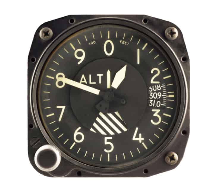
Some older altimeters have three needles, adding a very fine hand for 10,000-foot increments, and these three-pointer displays have a well-documented history of being misread under stress. Modern training aircraft often use a drum-counter altimeter instead, which shows the thousands on a rolling digital counter and uses just one needle for the hundreds. This is considerably easier to read quickly and accurately, particularly in poor visibility or high workload situations.
The other key feature on the altimeter face is a small window, typically on the right side of the dial, showing a number in inches of mercury or hectopascals. This is called the Kollsman window, and the number it shows is the pressure setting the altimeter is currently using. Turning the small knob below or beside the altimeter changes this number and adjusts the altimeter’s reading accordingly. This is the step that makes altitude meaningful.
How pilots read the altimeter in flight
The altimeter works by measuring atmospheric pressure. Air pressure decreases predictably as altitude increases: at sea level, the air above you weighs more than it does at 10,000 feet. The altimeter converts that pressure difference into an altitude reading. The problem is that atmospheric pressure at sea level also varies from day to day and place to place depending on the weather. On a low-pressure day, the surface pressure is lower than average. If the altimeter is not told about this, it will interpret that lower pressure as “higher up than sea level” and display a reading that is too high. The aircraft will be lower than the altimeter claims.
This is why pilots set the Kollsman window. Before every flight, and regularly throughout longer flights, the pilot dials in the current local pressure value, known as the QNH. With the correct QNH set, the altimeter shows the aircraft’s altitude above mean sea level. As a rule of thumb, pilots flying below 18,000 feet in the US update their pressure setting roughly every 100 nautical miles, or whenever they receive a new pressure value from air traffic control. The controller typically passes the current QNH when clearing a pilot to descend toward an airport.
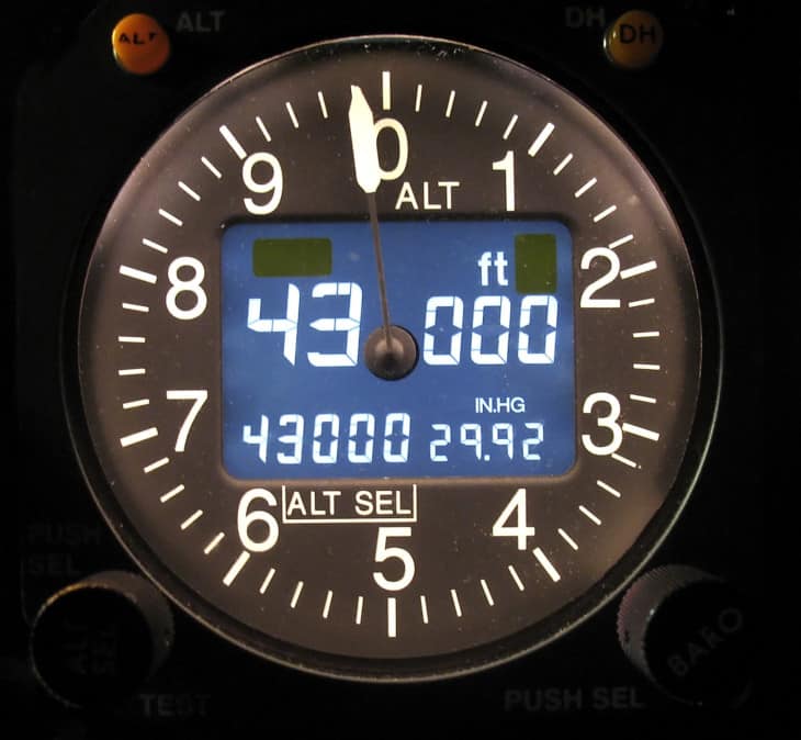
At higher altitudes, pilots do something different. Above a defined height called the transition altitude, all aircraft switch their altimeters to a single standard pressure value: 29.92 inches of mercury, or 1013.25 hectopascals. This eliminates the variation between different QNH values across a wide region and ensures that all aircraft flying at high altitude are using the same reference, which matters enormously for vertical separation. In the United States, this transition happens at 18,000 feet. Above that level, altimeter readings are called flight levels rather than altitudes: 18,000 feet on standard pressure is called Flight Level 180, or FL180. When descending back below the transition altitude, the pilot switches from standard pressure back to the local QNH for the destination area.
During a typical flight in a light aircraft, the pilot sets the QNH before takeoff, checks that the altimeter reads approximately the known airfield elevation as a sanity check, and then refers to the altimeter continuously throughout the climb, cruise, and descent to hold assigned altitudes and maintain safe terrain clearance. On approach, the altimeter is one of the primary references for flying the correct descent path, and at the decision point of an instrument approach, the pilot checks the altimeter reading against the published minimum altitude to decide whether to land or go around.
What pilots watch out for
The most consequential error a pilot can make with the altimeter is flying with an incorrect pressure setting. If the QNH dialled into the Kollsman window is too high, the altimeter will read above the aircraft’s actual altitude. The pilot believes they are higher than they are. In flat terrain this may go unnoticed, but on approach to an airport surrounded by rising ground, the aircraft could be below the minimum safe altitude while the altimeter suggests it is still safely above it. This is a direct route to controlled flight into terrain, where a perfectly functioning aircraft at flying speed flies into the ground or a hillside because the crew had a false picture of their height.
Altimeter setting error: a fatal example
On 25 December 2012, an Antonov 72 approaching Shymkent Airport in Kazakhstan crashed approximately 20 kilometres from the runway, killing all 27 people on board. Investigators found that the captain had failed to set the correct pressure on the barometric altimeters during the approach, leaving the instruments reading approximately 385 metres higher than the aircraft’s actual altitude. The crew believed they had safe terrain clearance. They did not.
A second common error is failing to update the pressure setting during a long flight. Pressure changes across regions, and a QNH that was accurate at departure can be several hectopascals off by the time the aircraft reaches the destination. Even a small difference in pressure setting translates to a meaningful error in the altitude reading: as a rough guide, one hectopascal of pressure difference corresponds to approximately 30 feet of altitude error. Over a three-hour flight crossing several weather systems, this can accumulate.

Altimeters can also fail mechanically, though this is rare in well-maintained aircraft. The typical failure mode is a stuck or sluggish needle, where the instrument lags behind the aircraft’s actual altitude change or stops moving altogether. Most aircraft carry two independent altimeters for this reason, and the pilot cross-checks them periodically to confirm they agree. A discrepancy between the two altimeters is always taken seriously and investigated before continuing the approach.
The altimeter in a glass cockpit
On a glass cockpit Primary Flight Display, altitude is shown as a vertical tape on the right side of the screen. A rolling counter in the centre of the tape shows the current altitude in feet as a large, easy-to-read number, and the tape scrolls up or down as the aircraft climbs or descends, giving a visual sense of the direction of movement. The current QNH setting is displayed at the bottom of the altitude tape as a small number, reminding the pilot at a glance what pressure reference the altimeter is using. Setting the pressure on a glass cockpit is done through the avionics controls rather than a physical knob, but the concept is identical: the pilot enters the local QNH, the system adjusts its altitude calculation, and the readout reflects the aircraft’s actual height above sea level.
The altimeter is one of the six instruments that make up the six-pack. For an overview of how all six work together as a group, see The Six-Pack: The 6 Classic Flight Instruments Every Pilot Relies On. The other instruments in the basic T alongside the altimeter are the attitude indicator and the airspeed indicator. For the full picture of cockpit instruments including glass cockpits and engine gauges, see Airplane Cockpit Instruments Explained.
FAQ
Get the Newsletter
The latest aviation news and stories sent to your inbox.
About the Author

Tim is the owner and lead editor of AeroCorner since 2019, overseeing aviation content covering aircraft, airlines, airports, and the broader aviation industry. Through years of researching, writing, editing, and publishing aviation-focused content, he has developed extensive practical knowledge of commercial aviation and air travel. Based in Asia and a frequent traveler himself, Tim also brings firsthand passenger experience to AeroCorner’s coverage. Outside of publishing, he has also explored aviation firsthand through hands-on flight training in New Zealand.