
One of the most incredible advancements in aviation has been the introduction of satellite navigation. But GPS technology alone isn’t enough—the regular GPS signals aren’t accurate enough to guide a plane to a safe landing during bad weather. So the FAA created a system to make GPS better and more accurate, called WAAS.
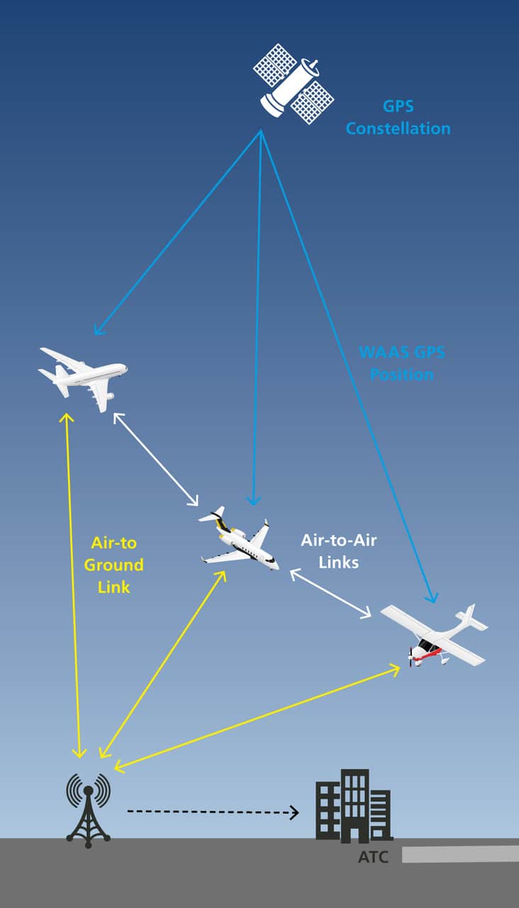
WAAS stands for Wide Area Augmentation System. Even though the FAA created it, many GPS receivers now use it to formulate more accurate positions. WAAS uses a separate network of ground stations and satellites to calculate any errors in the existing GPS network and help your receiver correct them.
What is GPS?
Before you can understand how WAAS works, you’ll need to have a rough understanding of how GPS (Global Positioning System) technology works. But, don’t worry—even though the GPS satellites are out in space, you don’t need to be a rocket scientist to understand this fantastic technology.
Inside the cockpits of nearly every airplane, GPS receivers provide an amazing amount of information to pilots. Even our cell phones and tablets use GPS for navigation, so it’s unlikely that any airplanes are left that aren’t using this technology.
The GPS receiver provides two excellent benefits to pilots. First, a GPS receiver can always tell you where you are. That might not sound like a big deal, but every technology before required combining several other resources to do the same job.
Secondly, a GPS can always take you directly to any other point in its database—or any other point on Earth. Since its computer has a list of NAVAIDs, airports, and fixes, the pilot can punch a few buttons and be pointed directly to anything.
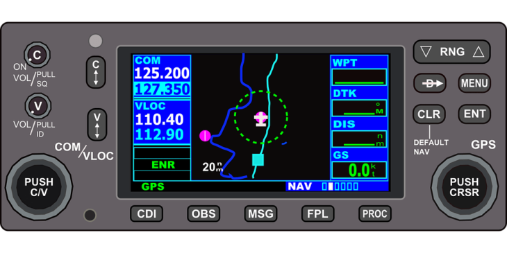
Most GPS systems are paired with moving map displays or MFDs (Multi-Function Displays). This gives the pilot a ton of information right at his fingertips.
How Does GPS Work?
So that’s what the GPS does for pilots, but how does the magic actually happen?
The key to the system is the constellation of GPS satellites orbiting Earth at all times. There are enough that many of them are in sight no matter where you are on the globe. Although some are kept as spares, the current GPS constellation consists of 30 satellites.
The GPS receiver in the airplane’s cockpit gets each satellite signal separately. The satellites only transmit one critical piece of data—the current time. Precise timekeeping is critical to the system.
You see, the entire system uses time and a navigation technique known as triangulation. The GPS knows where a satellite is located and when it sends out a signal. It keeps time well enough to know precisely how long it takes that signal to get from the satellite to the receiver.
Since the signal travels at the speed of light, you can use the time to calculate distance. So, for example, if it took 0.0025 seconds for the signal to get from the satellite to the plane, the receiver knows it must be 749,481.1 meters, or 404.7 nautical miles, away from the satellite.
Remember, this is all happening in three dimensions. So the data from one satellite is insufficient because it still means that the plane could be anywhere on the surface of a sphere with a radius of 404.7 nautical miles.
The receiver makes the same calculation several more times with other satellites. The more satellites it can see, the more accurate the receiver’s position. All of this goes on behind the scenes—all the pilot ever sees is the final result, which is the plane’s position.
Problems and Ways to Make GPS Better
GPS is a highly accurate system, as described above. In most cases, with three or more satellites in view, the system will accurately provide the user with their position within 15 meters (49 feet).
Why isn’t this accuracy any better? Well, for one thing, nothing is perfect. Some satellites might be slightly off-station. Some might have their clocks off by a millisecond. And weather or atmospheric conditions could change the speed of the radio transmission.
RAIM
There is a way for a receiver to eliminate a bad signal. For example, if one satellite providing data isn’t 100% accurate, eliminating it from the mix will improve the accuracy of the receiver’s position.
But how does it know which one might be suspicious? Aviation receivers use a technology known as RAIM (Random Autonomous Integrity Monitoring).
To do this, it will need one more satellite than is typical. The receiver randomly removes one satellite signal and calculates its position. It will then repeat the process but by removing a different satellite each time. In this way, it can check its position while also checking the integrity of the satellite signals its receiving.
Barometer Aiding
Another way to improve the accuracy of a GPS is by including in the receiver an altimeter. Providing an altitude reference is similar to adding an extra satellite. For example, if the receiver knows it’s 4,200 feet above sea level, that is similar to knowing it is 404.7 nautical miles from a satellite.
Satellite-Based Augmentation Systems (SBASs)
Another way that we can make GPS better is by calculating any errors in the system and then telling everyone’s receiver to correct that error. This is the basic idea behind an SBAS or Satellite Based Augmentation System.
What is WAAS EGNOS?
In the United States, the SBAS accessible to everyone is the FAA’s WAAS system. There are other systems worldwide, too, including EGNOS in Europe, MSAS in Japan, and GAGAN in India.
What does WAAS stand for? WAAS means Wide Area Augmentation System. And even though the FAA operates the WAAS network in the United States, the signal is available to all users.
The FAA and Department of Transportation created the WAAS network to support approaches into airports. Without WAAS augmentation, GPS receivers are not accurate enough to navigate the terminal and approach environments.
How Does WAAS Work to Improve GPS Accuracy?
Here’s how it works. There are ground stations set up around the country—they do not move, and their position is precisely known. They each have a GPS receiver that always gets a position from the satellites. When the satellite-derived position and the known position do not match, there is an error in the system.
That error is then set back to another satellite and rebroadcast. A compatible GPS receiver can receive the error correction and apply it to its position calculations. So a GPS with WAAS works just like a regular one but always adds in real-time error corrections.
Not all GPSs have this capability. To use WAAS, your receiver must support it and receive the signal from the WAAS satellite.
How much better does WAAS make your GPS? Compared to the standard GPS accuracy of 15 meters, a WAAS unit can usually pin down your position within less than three meters (9.8 feet).
Sources and references used for research and fact-checking.
Get the Newsletter
The latest aviation news and stories sent to your inbox.
About the Author
Matt Claiborne is an FAA Airline Transport Pilot and Certified Flight Instructor with more than two decades of experience in flight training. He has served as an assistant professor and FAA Part 141 Assistant Chief Instructor for a university aeronautics program in Florida. His background in professional flying, flight instruction, and aviation education gives him firsthand expertise in aircraft operations, pilot training, flight procedures, and aviation safety.